


World Heritage Squared
This walking trail takes you through no fewer than two world heritage sites: the Beemster reclamation and the Dutch Water Lines (including the Defense Line of Amsterdam). A unique experience!
Dykes, forts, an inundation sluice, panoramic views over land that has been reclaimed from water, the lowest-lying arboretum in the world, farmhouses and stalls where you can buy the most delicious regional products that the Beemster has in season, directly from the land. You will find it all along this trail.
The connecting routes make it possible to shorten this walking route to a length of 10 or 14 kilometers. The route can be extended to 20 km if you combine the route with the Canal Walk or City Walk through Purmerend.
Reclamation de Beemster
The Beemster in North Holland is a textbook exampl…
Dykes, forts, an inundation sluice, panoramic views over land that has been reclaimed from water, the lowest-lying arboretum in the world, farmhouses and stalls where you can buy the most delicious regional products that the Beemster has in season, directly from the land. You will find it all along this trail.
The connecting routes make it possible to shorten this walking route to a length of 10 or 14 kilometers. The route can be extended to 20 km if you combine the route with the Canal Walk or City Walk through Purmerend.
Reclamation de Beemster
The Beemster in North Holland is a textbook example of how the Dutch have reclaimed large parts of their country. This 17th century polder was set up to convert the threatening inland lake the Beemstermeer into fertile and profitable agricultural land. A sturdy dyke of 42 kilometers long was built around the wild lake and a ring canal was dug around it. Then, 43 windmills started pumping the water out of the lake.
In 1612 De Beemster was fully dry and the layout of the polder could begin. Roads were built, road ditches and plot ditches were dug and farms were built. All this happened according to an orderly and strict geometric pattern. De Beemster owes its fame to this rational subdivision and layout.
Dutch Water Lines (the Defense Line of Amsterdam)
The Defense Line of Amsterdam is a defense line of forts that was built between 1880 and 1914, 15 to 20 kilometers around Amsterdam. Within this ring, the army, the government and the king could withdraw from (possible) attacks on the Netherlands. Through an ingenious system, the land around the defense line could be flooded. Too shallow for boats and too deep for soldiers on foot and cavalry. This made raids more difficult. However, even before construction was completed, the defence line was already obsolete by the advent of the airplane.
During the two world wars, the forts were put in a state of defense. Ultimately, there was never any fighting on the forts. Five forts and an inundation lock of this defense line are located in De Beemster. Some of these fascinating buildings can still be admired in their original state. Other fortresses have been given a new destination, such as the Fort aan de Nekkerweg, which is now a wellness resort.
Since July 2021, UNESCO has placed the Dutch Water Lines on the World Heritage List. The defense lines, the Defense Line of Amsterdam and the New Dutch Water Line, will continue as one World Heritage Site under the name 'Dutch Water Lines'.
Neem alvast een kijkje


Dit ga je zien
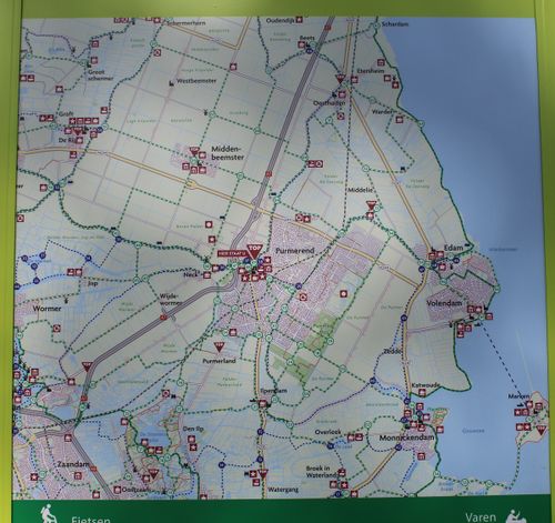
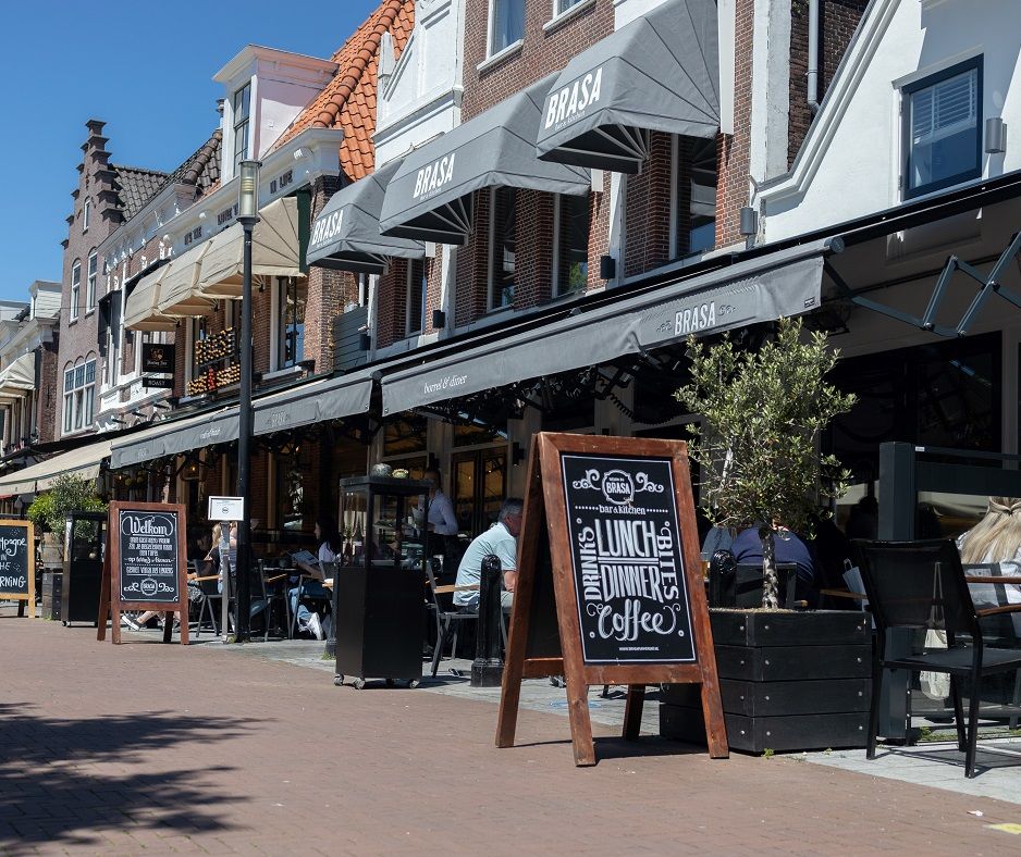
Tourist Transfer Point (TOP) Purmerend
TOPs are Tourist Transfer Points. You can park your car at each TOP and then discover the rural surroundings by bike, on foot or by boat.

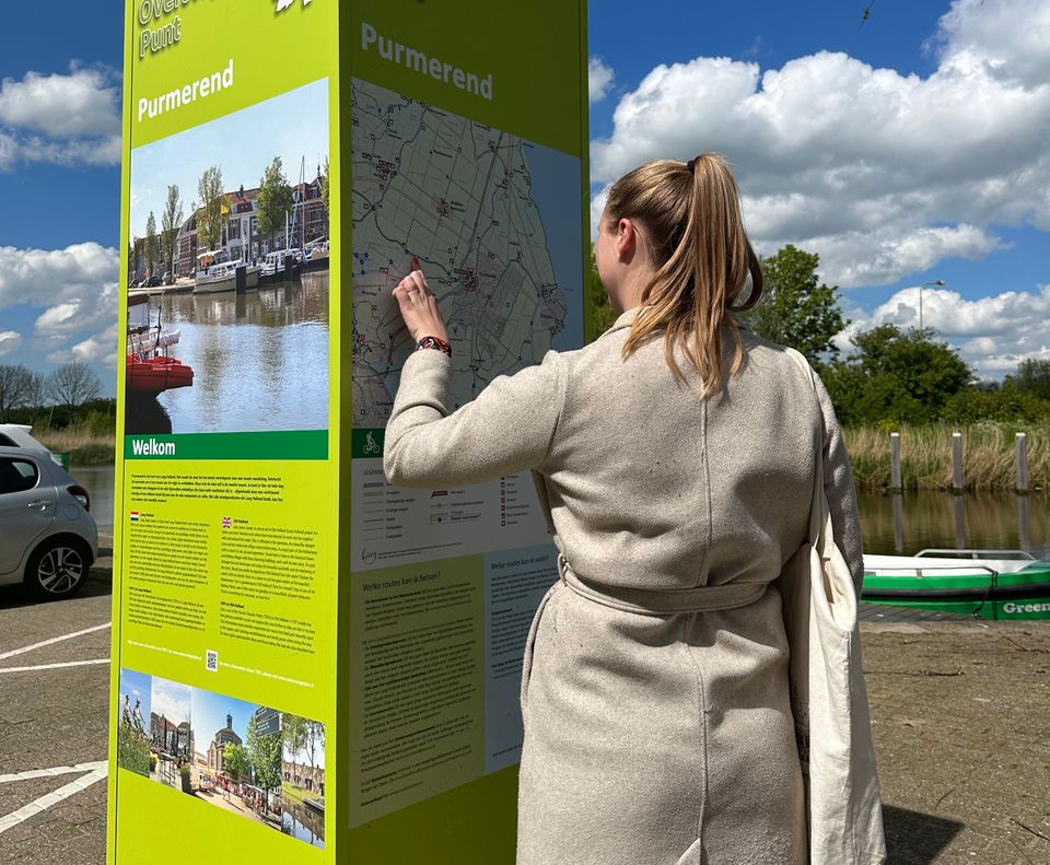
Tourist Transfer Point (TOP) Purmerend
TOPs are Tourist Transfer Points. You can park your car at each TOP and then discover the rural surroundings by bike, on foot or by boat.
TOP Purmerend is located on the edge of the city center, on the Beemsterburgwal. Purmerend's cycling, walking and boating network come together here, making it the perfect base from which to discover the unique and beautiful locations in Purmerend and the surrounding area.
At each TOP you will find routes on the information column that introduce you to the most beautiful places, the tranquility and nature in Laag Holland. Along the way, there are rest stops and catering establishments at surprising locations. The TOPs will help you find them. The TOPs can be recognized by the green information columns.
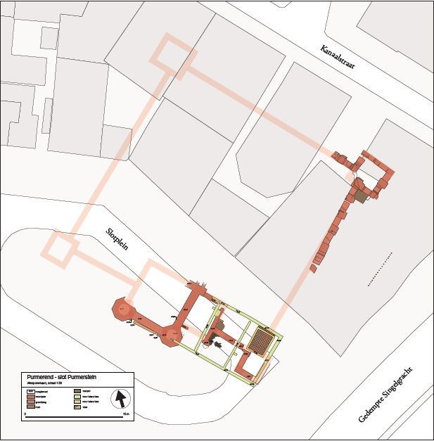
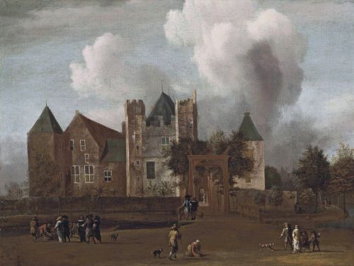
Information panel | Slot Purmersteijn | Slotplein
The Slotplein is an important, historic place for Purmerend. There is not much left to see now, but this used to be the location of an enormous castle, with large donjons on the corners and huge halls. Even bigger than the Muiderslot!

Information panel | Slot Purmersteijn | Slotplein
The Slotplein is an important, historic place for Purmerend. There is not much left to see now, but this used to be the location of an enormous castle, with large donjons on the corners and huge halls. Even bigger than the Muiderslot!
The important administrative and military center Slot Purmersteijn was built in 1410 by the wealthy banker Willem Eggert. As treasurer of Holland and Zeeland, he was one of the most powerful men in the county. He used his power to tackle fraud and bribery within the Dutch nobility. Under his leadership, West Friesland, Texel and the Kop van Noord-Holland were liberated from the tyranny of the nobles and most villages became self-governing.
Eggerts actions were not appreciated by the nobles. During his life he received many angry letters from the Dutch nobility. After his death, his family was rejected by this group. Because of this, the name Eggert has no further relevance in Purmerend history. The castle also came back into the hands of the noble families, who left the management entirely to a castellan. Over the centuries, Slot Purmersteijn became a hated symbol of the power of the castellan and in particular the Prince of Orange. When the opportunity presented itself, the regents of Purmerend demolished the castle in 1741.
On the castle square, where the entrance to the castle was originally, you will only find a replica of a part of the castle wall.
Information panel | Necker-Poort | Neckerdijk
The Neckerpoort (Neck Gate) is one of the five former gates of the old city of Purmerend.
Information panel | Necker-Poort | Neckerdijk
The Neckerpoort (Neck Gate) is one of the five former gates of the old city of Purmerend.
When Purmerend received city status in 1410, earthen walls were built around the city to keep out any potential enemies. Initially, four city gates were built, but after the reclamation of the Beemster a fifth was added. Anyone who wanted to enter the city came through one of these gates, after paying the gate fee of course.
The old wooden Neckerpoort was later replaced by a stone one. However, the gate was demolished in 1818 to make room for the Noordhollandsch Kanaal (North Holland Canal). In 2013, the Nieuwe Neckerpoort was built opposite the location of the old gate, where a fine catering facility offers a recognizable image of the inns that used to be built around the city gates.

Painted panels
Look at the panels on the building on the corner of the Nieuwstraat and the Gouw. These panels show a piece of Purmerend’s history.

Painted panels
Look at the panels on the building on the corner of the Nieuwstraat and the Gouw. These panels show a piece of Purmerend’s history.
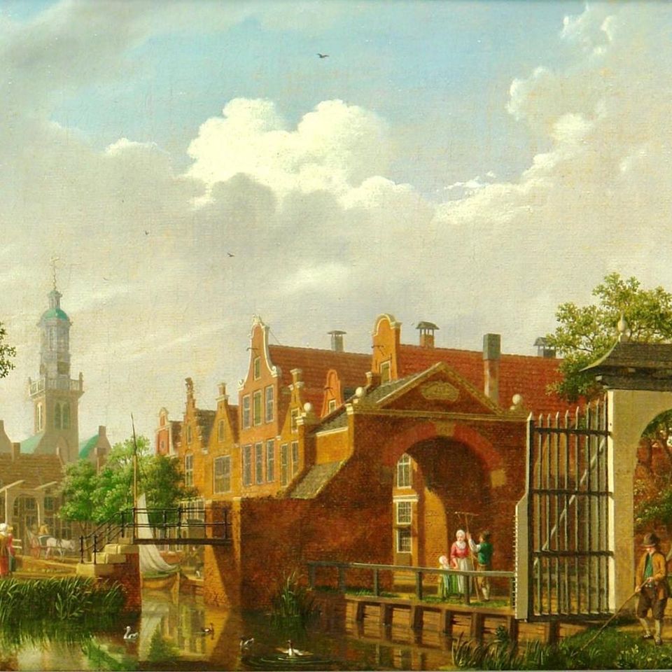
Information panel | Postbrug | Herengracht
The first building outside the city walls of Purmerend was built around 1900. The impressive mansions on the Herengracht and Emmakade are still here today.
Information panel | Postbrug | Herengracht
The first building outside the city walls of Purmerend was built around 1900. The impressive mansions on the Herengracht and Emmakade are still here today.
A brand new post office was also built. The bridge that connects this neighborhood with the city center was therefore called the Post Bridge. The post office has not been in use for many years, but the name of the bridge has stuck.
Information panel | Bastion | Wolthuissingel
The Bastion, or stronghold, was built in 1645 in order to strengthen the defenses of the city.
Information panel | Bastion | Wolthuissingel
The Bastion, or stronghold, was built in 1645 in order to strengthen the defenses of the city.
Here, you can still see the shape of this old stronghold, which consisted of a ring of canals and moats, and an earthen wall.
The earthen walls have given way to green gardens, but the canals are still clearly visible.
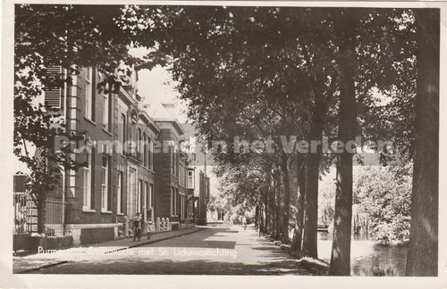
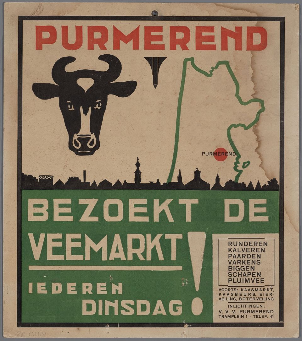
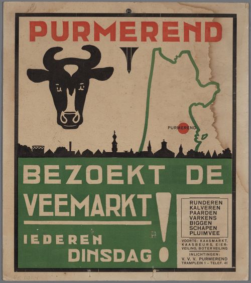
Koemarkt (Cattle Market)
Until the eighties of the last century, Purmerend was a bustling 'Market City'. Every week, the Koemarkt would be full of cattle, ready to be sold.
Koemarkt (Cattle Market)
Until the eighties of the last century, Purmerend was a bustling 'Market City'. Every week, the Koemarkt would be full of cattle, ready to be sold.
But there was much more to do than just cattle trade. How about cheese, fish, sheep and pigs? For each product group, a specific square was allocated in the city, which made for a lively city centre. Tuesday is still market day in Purmerend. The cattle markets are now a thing of the past and that is why the Koemarkt has been given a new use. The Koemarkt has become a centre for gastronomy, with cozy cafes and nice restaurants. Many events also take place here. All of this makes the Koemarkt the 'living room' of the region!
Take a good look at the pavement of the square. Here is another reminder of the earliest history of Purmerend: five stone plaques depicting the history of the Saint Ursula Monastery that was founded on this site in 1392.
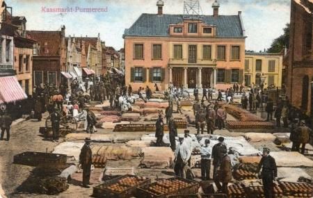
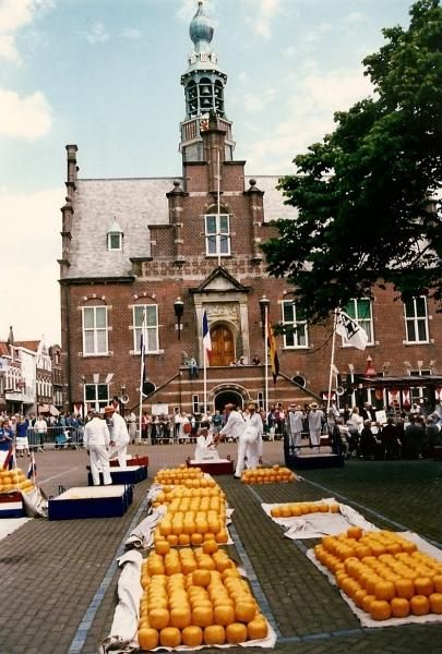
Information panel | Kaasmarkt (Cheese Market)
The Kaasmarkt in Purmerend has a market history of more than 600 years. The first small-scale market was held here in 1484, when it was still called Marktveld and was no more than a small square.
Information panel | Kaasmarkt (Cheese Market)
The Kaasmarkt in Purmerend has a market history of more than 600 years. The first small-scale market was held here in 1484, when it was still called Marktveld and was no more than a small square.
After the reclamation of De Beemster in the early 17th century, the market really started to grow. In order to cope with this growth, a number of things were reorganized in the city. The cattle market was moved to the old Kloosterwerf (now the Koemarkt). The square itself also changed. A few buildings were demolished to make room, the town hall was set back 10 meters, the main church was demolished and even the graveyard was closed and paved for market trade.
Eventually all markets were spread over the city and only cheese was traded on the Kaasmarkt. Up to four million kilos yearly! The Purmerend cheese market was the second largest cheese market in the Netherlands, after Alkmaar. Nevertheless, the Purmerend cheese market was more innovative. In Alkmaar the cheeses were still transported to the Waag on barrows carried by cheese carriers, in Purmerend cheese trays with a set of wheels were used. The backs of the cheese carriers lasted longer in Purmerend!
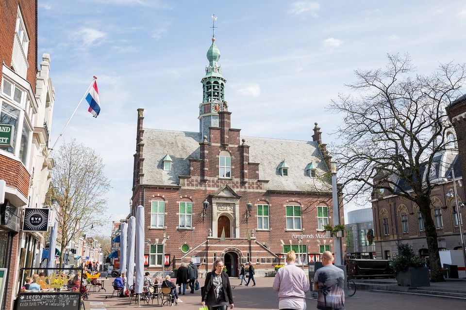
In the mid-20th century, the industrialization of the dairy industry won the battle over the traditional cheese market. Shortly before 1940, the very last cheese market was held in Purmerend. The success of this has certainly contributed to Purmerend's status as the market town of North Holland. A visit to the Cheese Market is still worth it. You will find terraces, the Nicholas Church and the imposing Purmerends Museum in the old town hall.

Oostdijk / Beemsterringvaart | World Heritage Site the Beemster Reclamation
In 1607 the States of Holland and West Friesland granted permission to drain the Beemster lake. It would be a profitable project that could also contribute to the food supply of fast-growing Amsterdam.
Oostdijk / Beemsterringvaart | World Heritage Site the Beemster Reclamation
In 1607 the States of Holland and West Friesland granted permission to drain the Beemster lake. It would be a profitable project that could also contribute to the food supply of fast-growing Amsterdam.
A high and sturdy dyke of 38 kilometers long was built around the lake and a canal was dug around it. Then began the long process of pumping all the water out of the lake, which required no fewer than 43 windmills. Engineer Jan Adriaenszoon Leeghwater is partly responsible for the construction and installation of the windmills. Mills were built in rows at increasing elevation levels, each pumping water from one to the next, higher and higher untill reaching the canal outside of the dyke.
In 1612, the last water was pumped out of the lake and the constructing of the polder could begin. Roads were built, ditches were dug and farmhouses were erected. Everything happened according to an orderly and strict geometric pattern. The Beemster owes its fame to this way of dividing and allocating land.
The Netherlands has been shaped by human intervention in nature. That begins as early as the sixth century BC. with the construction of mounds and mounds to be able to live safely. In the Middle Ages, land reclamation and diking followed on an increasingly large scale and the establishment of water boards. From the sixteenth century, water management was tackled on an even larger scale and systematically with the draining of lakes and peat ponds. The Beemster is now on the UNESCO list of World Heritage. This polder is a textbook example of how the Dutch have 'made' large parts of their country themselves.
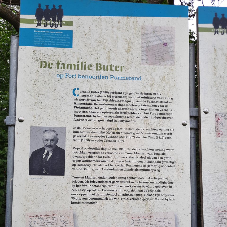
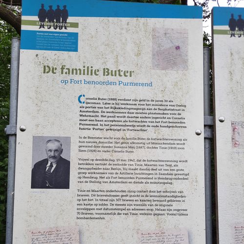
Information panel | Buter family
This information panel tells the story of the 'forgotten' keeper of Fort Benoorden and his family.
Information panel | Buter family
This information panel tells the story of the 'forgotten' keeper of Fort Benoorden and his family.
Cornelis Buter (1888) and his family were forced to move to the fort watchman's house in the Fort north of Purmerend during the Second World War. His daughter, Tinie, was engaged to Maarten van Tent who was sent to Berlin as a forced laborer.
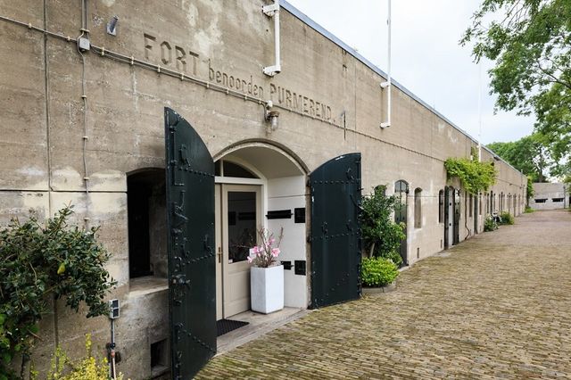
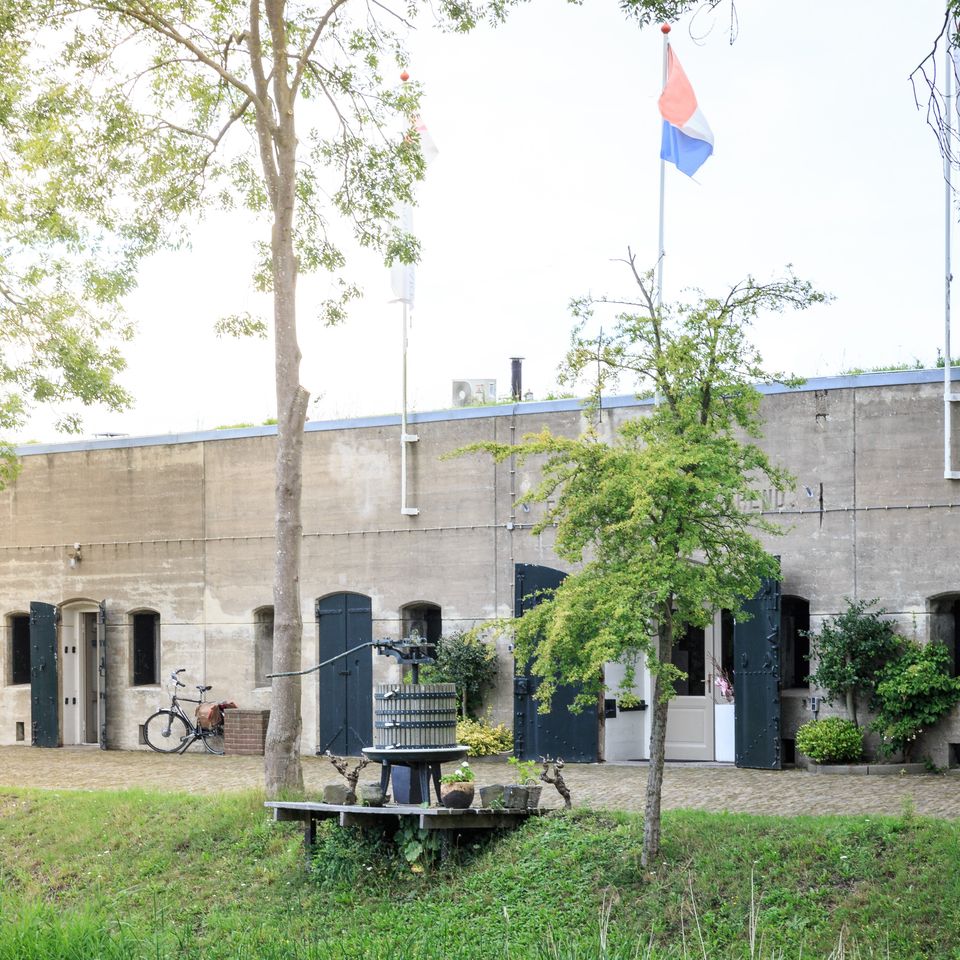
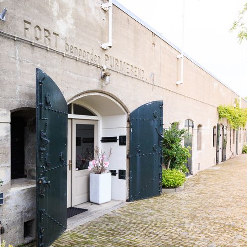
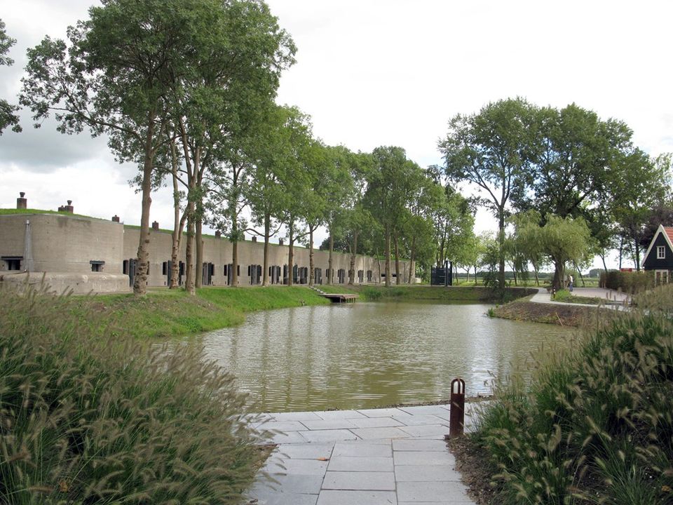
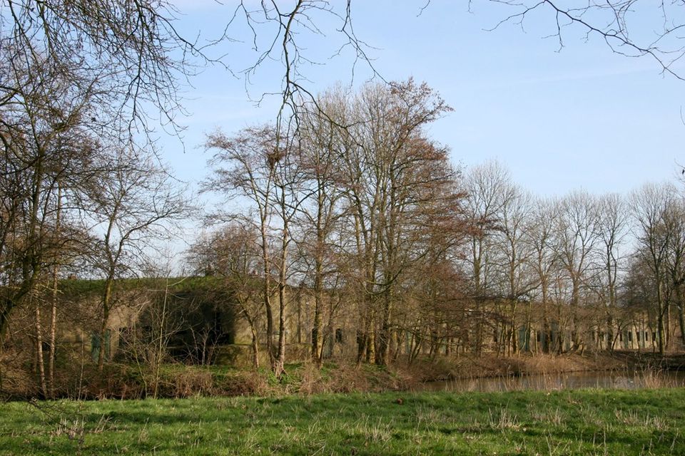
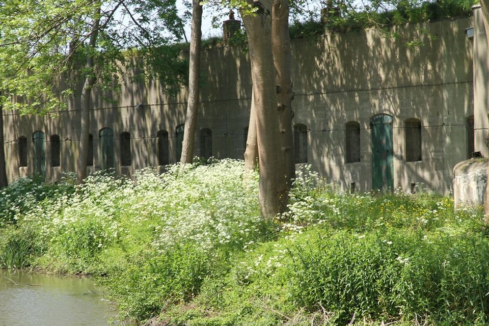
Fort Benoorden
Fort Benoorden is one of the fortresses of the Defense Line of Amsterdam, which is part of the UNESCO World Heritage 'Dutch Water Lines'. This defense line was constructed between 1880 and 1914, 15 to 20 kilometers around Amsterdam.

Fort Benoorden
Fort Benoorden is one of the fortresses of the Defense Line of Amsterdam, which is part of the UNESCO World Heritage 'Dutch Water Lines'. This defense line was constructed between 1880 and 1914, 15 to 20 kilometers around Amsterdam.
Within this ring of fortresses, the army, the government and the king could withdraw from (possible) attacks on the Netherlands. Through an ingenious system, the land around the defense line could be flooded. Too shallow for boats and too deep for man and horse. Five forts and an inundation lock of this defense line are located in the Beemster.
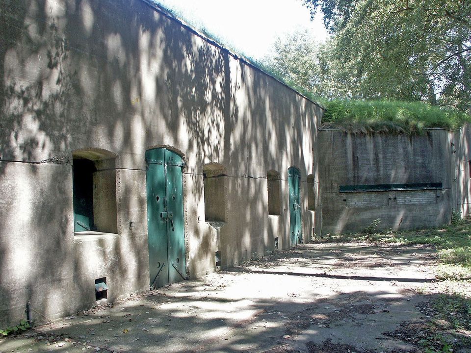
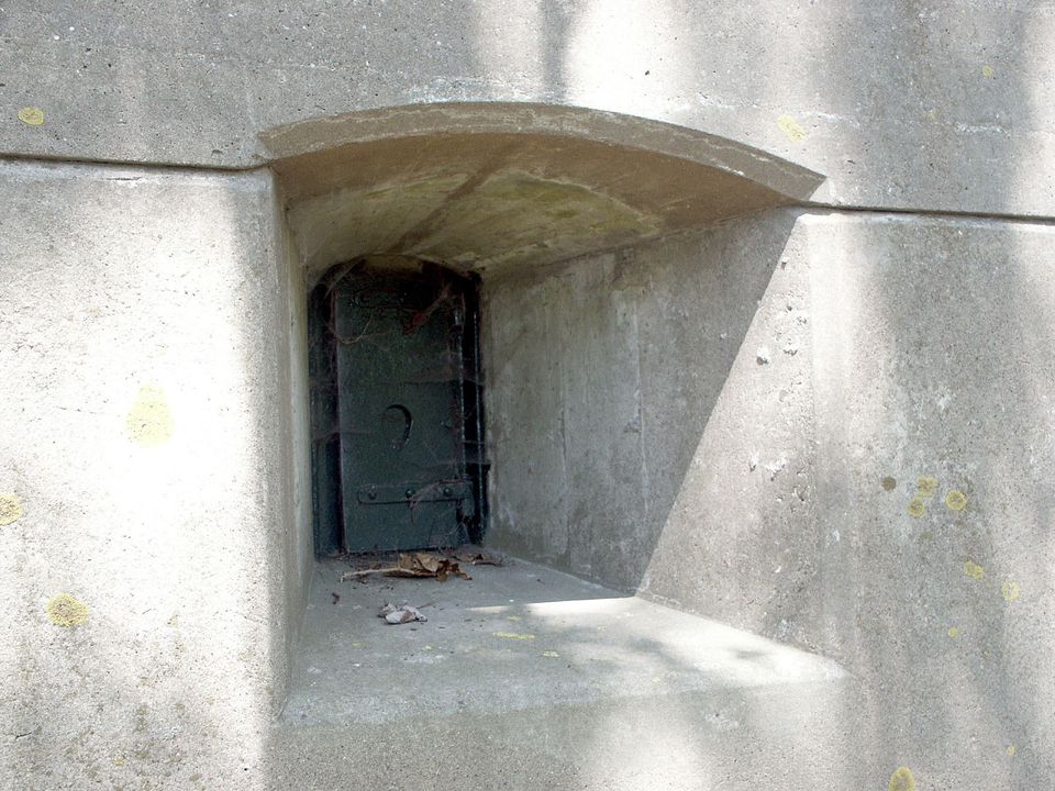
This fort was built to defend the vulnerable points formed by the Beemsterringdijk, Purmerenderweg and Rijperweg and was completed in 1895. The bombproof main building from 1912 is connected to the two smaller dome buildings by covered corridors. Today, wine is stored between the thick walls of this fortress, because a wine importer has set up shop here in 1981.
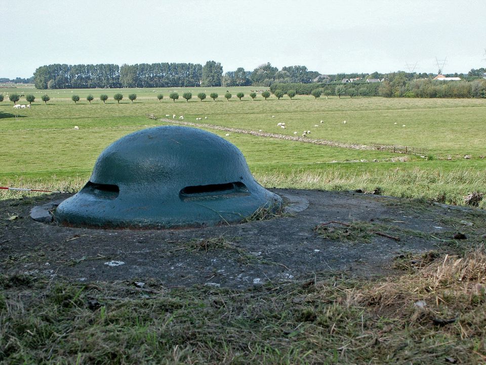
The fort north of Purmerend was only added to the Defense Line of Amsterdam at a later stage (1907). A number of new insights were used in the construction of this fortress, which is part of the northern front of the Defense Line. One of the innovations that was applied was the construction of so-called posterns - corridors covered with steel and concrete - which formed a completely safe connection between the main building and the gun units. Posterns were built leading to the two armored turrets, in which the large artillery pieces were positioned, and to the machine gun positions that were positioned at the front.
Information panel | Deutzen-Hofje farm
This farm was built in 1881 by order of the Amsterdam Deutzenhofje. This distinguished court on the Prinsengracht was built in 1694-95, financed from the estate of Agneta Deutz.

Information panel | Deutzen-Hofje farm
This farm was built in 1881 by order of the Amsterdam Deutzenhofje. This distinguished court on the Prinsengracht was built in 1694-95, financed from the estate of Agneta Deutz.
The farm owes its name to this lady. From an estate she acquired the plots AK 12 and 13 and HK 101, a total area of 60 morgen (a morgen is an old measurement that indicates how much land can be plowed in one morning. Depending on the area, a morning is about one hectare). Wouter Sluis, a pioneer in the field of dairy preparation, agriculture and horticulture, moved into the Deutzenhofje on December 2, 1858. in 1881 the farm was replaced by a new building. The rear area with the rooms for milk processing, livestock sheds, etc. was built on the instructions of Sluis and entirely in accordance with his wishes.
Fort on the Nekkerweg
The fortress on the Nekkerweg is one of the fortresses of the Defense Line of Amsterdam, which is part of the UNESCO World Heritage 'Dutch Water Lines'. This defense line was constructed between 1880 and 1914, 15 to 20 kilometers around Amsterdam.
Fort on the Nekkerweg
The fortress on the Nekkerweg is one of the fortresses of the Defense Line of Amsterdam, which is part of the UNESCO World Heritage 'Dutch Water Lines'. This defense line was constructed between 1880 and 1914, 15 to 20 kilometers around Amsterdam.
This fortress caused a kink in the main defense line. To prevent Zuidoostbeemster from being flooded in the event of inundation of the Beemsterpolder, both the Nekkerweg and the Volgerweg were raised. This fortress was to prevent the enemy from moving easily via these two elevated roads.
The Fort on the Nekkerweg was not completed until 1912. The fortress was given another destination almost immediately afterwards. In 1918 it was used as a military prison. In the period since then, many conscientious objectors have served their sentences here. Virtually nothing remains of the original interior of the fort. However, the concrete machine-gun emplacements on the front wall have remained reasonably intact, as has the fort guard's house.
The fortress that used to house soldiers has now been transformed into a luxury eco-chic wellness resort, with two restaurants and 16 luxurious rooms and suites.

Rustenhove
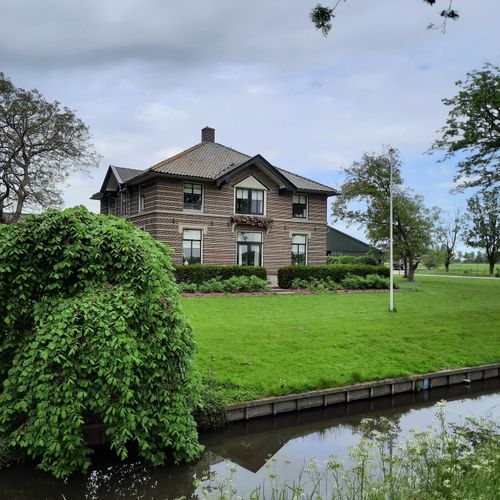
This mansion was built in Louis XV style. It stands on the site of a former country estate. Striking are the 'corner pilasters' and decorated entrance with the year 1768 and the coat of arms.

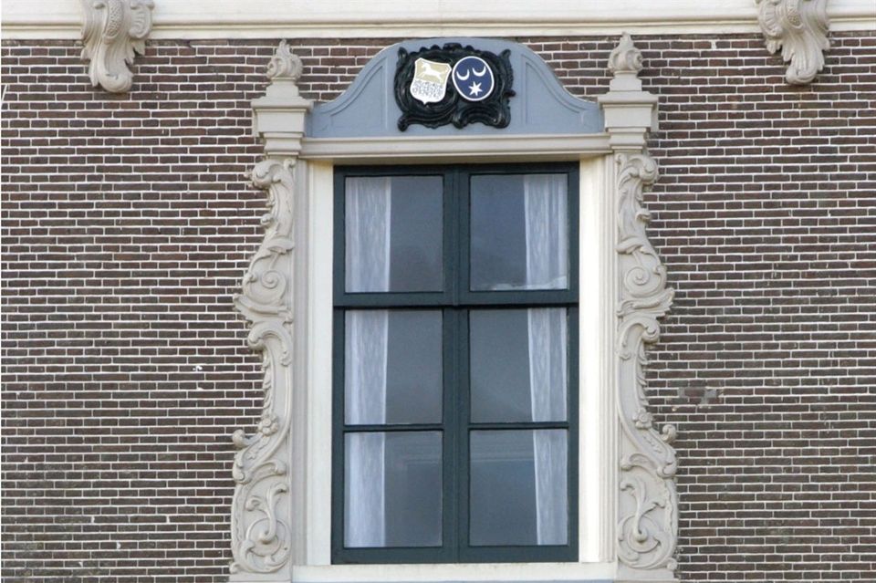
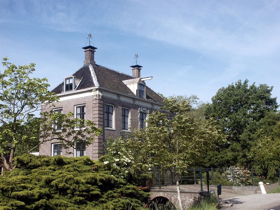
Rustenhove
This mansion was built in Louis XV style. It stands on the site of a former country estate. Striking are the 'corner pilasters' and decorated entrance with the year 1768 and the coat of arms.
The beautiful cast iron gate and the arch bridge date from the same period. The location started as a livestock farm, but it is now an arable farm. The statue to the right of the farm is the god Jupiter, after which the former estate was named in 1646. The statue comes from the polder house on the Noorddijk.
Intersection Volgerweg / Middenweg
This intersection is also known as the 'crossroads of four centuries of architecture'.
Intersection Volgerweg / Middenweg
This intersection is also known as the 'crossroads of four centuries of architecture'.
Eenhoorn farm, which dates back to 1682, is on the Middenweg; on the Volgerweg, a house built in the 20th century stands next to Rustenhoven, which was built in 1768. Across from this mansion is a 19th century farmhouse; it is home to the collection garden of the POMological Society of North Holland. More than 250 fruit varieties have been newly planted here.

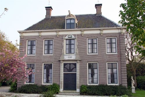
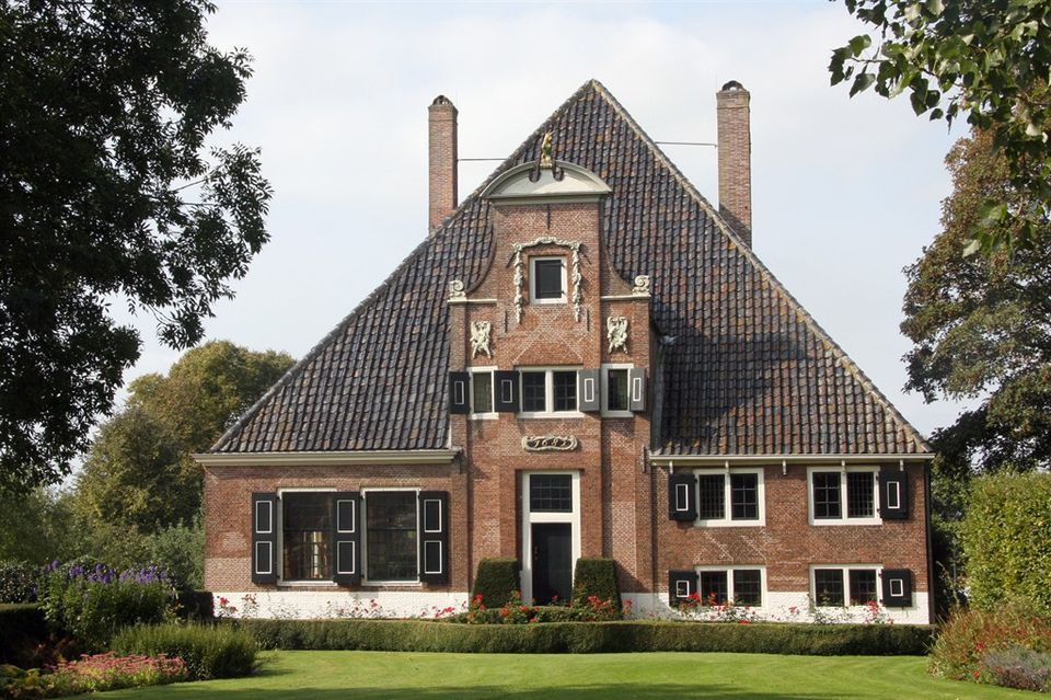
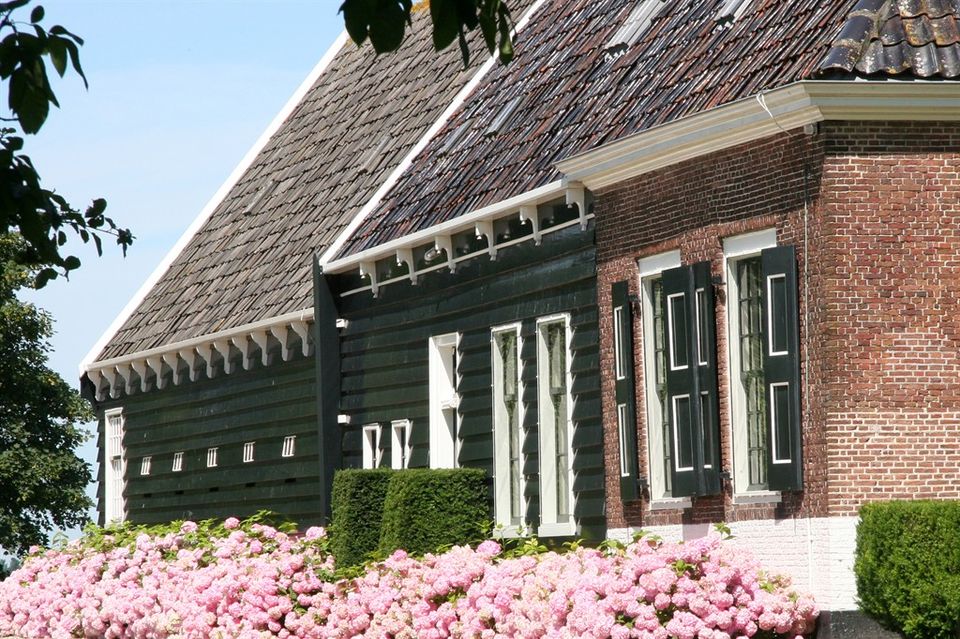
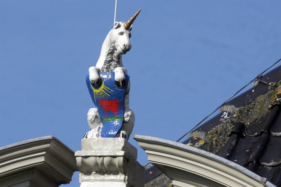
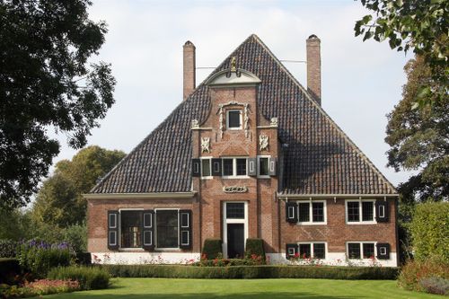
"De Eenhoorn" farm
Farm "De Eenhoorn" (the Unicorn) is a prime example of a farmhouse in De Beemster. The living area is made of brick and the rear-extended stable area of wood.
"De Eenhoorn" farm
Farm "De Eenhoorn" (the Unicorn) is a prime example of a farmhouse in De Beemster. The living area is made of brick and the rear-extended stable area of wood.
The raised central part of the 'neck' gable is a variant of the Amsterdam Vingboons style (Philip Vingboons). The gable is crowned with, among other things, the image of a unicorn and decorated with carved facade ornaments. The living area has a partial basement and the milk cellar has a tiled fireplace.
The large orchards are typical of these farms. These had several functions: in addition to producing fruit, they also provided coppice and edible wood. In early spring, the sheep grazed in the orchard with their newborn lambs. Later in the summer, the calves grazed there. The principal at the time was the mayor of Hoorn.
Fort on the Middenweg
The fortress on the Middenweg is one of the fortresses of the Defense Line of Amsterdam, which is part of the UNESCO World Heritage 'Dutch Water Lines'. This defense line was constructed between 1880 and 1914, 15 to 20 kilometers around Amsterdam.
Fort on the Middenweg
The fortress on the Middenweg is one of the fortresses of the Defense Line of Amsterdam, which is part of the UNESCO World Heritage 'Dutch Water Lines'. This defense line was constructed between 1880 and 1914, 15 to 20 kilometers around Amsterdam.
The fort is located on the southern ring dyke of the Beemster polder. The Noordhollandsch Kanaal runs behind the fort and the dyke. An inundation lock for the Beemster is located east of the fort. The purpose of the fort was to close off and defend the access roads the Middenweg and the Zuiddijk. The original situation around the fort has been preserved: open polder landscape outside the Stelling and the dyke and canal within the Stelling.
The fort has been in use as a warehouse complex from an unknown date until after 1974 and on 1-12-1950 as a gunpowder warehouse. Later used by Eurometaal (formerly Artillerie Inrichtingen); still in use in 1980/1983. The facilities for a Detention and Residence Camp for political offenders were partially installed in 1946, but the fort has not been used as a camp.
Flora & Fauna are of great natural value. Due to the strong temperature changes on the bare fortress terrain, a clear dune vegetation occurs here. You can find, among others, Stonecrop, Sand Wall, Real Walstraw, Ragwort and Early Forget-me-not. There are also Wolf's Foot, Pink Water-speedwell and Pennywort. The long-eared owl and the freshwater shrimp are also residents of the nature reserve around the fort.
A special feature of this fort was the washroom for the soldiers. Rainwater is cleaned by an ingenious system before it ends up in the sinks. After use, soldiers can tip over the sinks, so that the dirty water flows away.
The Fort on the Middenweg can be admired, but cannot be visited.

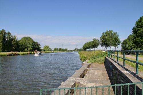
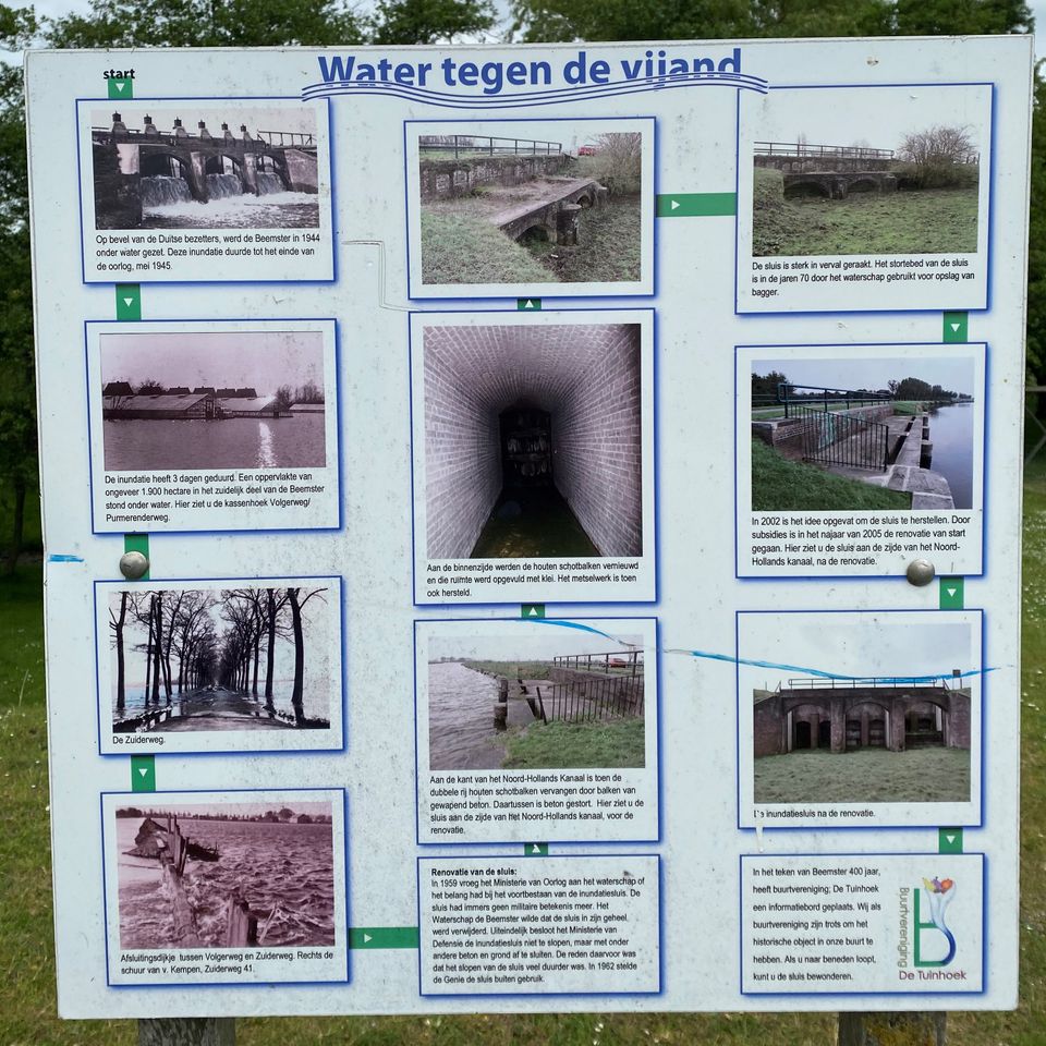
Inundation lock in Zuidelijke Beemsterringdijk
The Inundation Lock is part of the Defense Line of Amsterdam and was constructed by the War Department between 1890 and 1891.
Information panel | Water Against the Enemy
This information panel tells the story of the Inundation Lock from the Second World War to the present.
Information panel | Water Against the Enemy
This information panel tells the story of the Inundation Lock from the Second World War to the present.
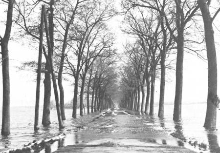
On the orders of the German occupiers, the Beemster was flooded in 1944. This inundation lasted until the end of the war, May 1945. It took three days for the inundation to be completed. An area of approximately 1900 hectares in the southern part of the Beemster was put under water. On the information panel you can see images of a flooded Beemsterpolder.
Renovation of the Lock
In 1959 the Ministry of War asked the water board whether it had an interest in the continued existence of the inundation sluice. After all, the lock no longer had any military significance. The Beemster Water Board wanted the lock to be removed in its entirety. Ultimately, the ministry decided not to demolish the lock, but to close it off with concrete and soil, among other things. The reason for this was that demolishing the lock was much more expensive. The lock was officially decommissioned in 1962.
On the side of the Noord-Hollandsch Kanaal, the double row of wooden bulkhead beams was replaced by reinforced concrete beams. Concrete was poured in between. On the inside, the wooden bulkhead beams were renewed and that space was filled with earth. The masonry was also repaired. The information panel shows the lock before the renovation.
By the end of the 20th century, the lock had fallen into serious disrepair. The dumping bed of the lock was used by the water board in the 1970s to store dredged material. in 2002 the idea was conceived to restore the lock. The renovation started in the autumn of 2005, financed by subsidies. On the information panel you can see the lock after the renovation.

Information panel | Beemster War Memories
Read about De Beemster in the Second World War on this information panel.

Information panel | Beemster War Memories
Read about De Beemster in the Second World War on this information panel.
Information panel | Beemster-Poort | Beemsterburgwal
The Beemster-Poort (Beemster Gate) was the fifth and last city gate to be built around Purmerend.
Information panel | Beemster-Poort | Beemsterburgwal
The Beemster-Poort (Beemster Gate) was the fifth and last city gate to be built around Purmerend.
The first four gates were built after obtaining city status in 1410. The need for a fifth gate arose after the reclamation of the Beemster in 1612. A simple wooden gate was built on the bridge from the city to the newly acquired land: The Beemster Gate. When De Beemster was reclaimed and the roads were passable, this route was used to move towards Oosthuizen and Hoorn. As a result, the access road through the Hoornsche Poort was hardly used anymore.
During a period of peace, the city walls and city gates became redundant as defense works. If an enemy did arrive, the retractable bridges could be used to protect the city. Between 1830 and 1840, all gates in Purmerend, with the exception of the Amsterdamsche Poort, were demolished.
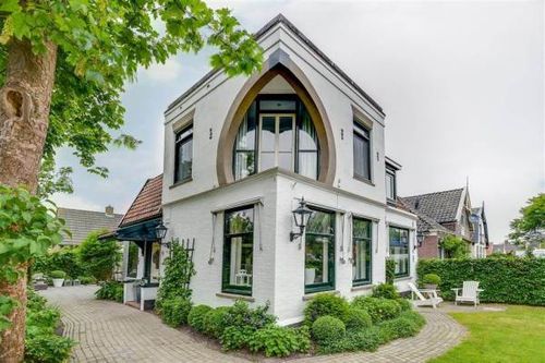
Information panel | Remarkable house
This house was built around 1900 by contractor Kerkhof. He was also the first resident.

Information panel | Remarkable house
This house was built around 1900 by contractor Kerkhof. He was also the first resident.
This house has a special architectural style. In the corner of the second floor, for example, a special window has been built with a balcony. Unfortunately, no further information was found in the archives.
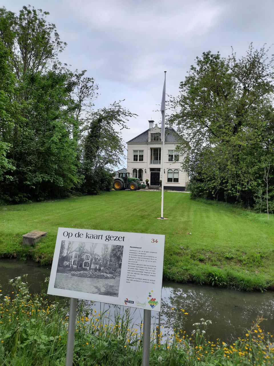
Information panel | Mariënheuvel
Mariënheuvel is one of the last remaining country estates in the Beemster. The country estate has existed since the reclamation of the Beemster in 1612 as inner lot 96 and was owned by Dick van Os, one of the founders of the Dutch East India Company.
Information panel | Mariënheuvel
Mariënheuvel is one of the last remaining country estates in the Beemster. The country estate has existed since the reclamation of the Beemster in 1612 as inner lot 96 and was owned by Dick van Os, one of the founders of the Dutch East India Company.
The country house was built in 1820 by the well-known Pumerender and timber merchant Klaas Brantjes for his beloved Maria ('Maartje') Stuyt. The country estate was originally called "Volgerlust", but it was renamed after his wife by Klaas Brantjes. Mariënheuvel is privately owned and the estate has been symmetrically renovated and expanded since 2005.
Information panel | Wooden house
The "Kringenwet" is a Dutch law from 1814, revised in 1853. The purpose of the law was to keep the field of fire around fortifications free. Demolition, construction, harvesting and planting within the Forbidden Circles was regulated in this law.

Information panel | Wooden house
The "Kringenwet" is a Dutch law from 1814, revised in 1853. The purpose of the law was to keep the field of fire around fortifications free. Demolition, construction, harvesting and planting within the Forbidden Circles was regulated in this law.
This so-called "Kringenwetwoning" from 1914 had to meet certain building requirements because of the "Kringenwet" (1853-1963). Because the house was built within a radius of 500 to 600 meters from Fort Nekkerweg, a stone foundation was allowed to be placed with a wooden structure on top.
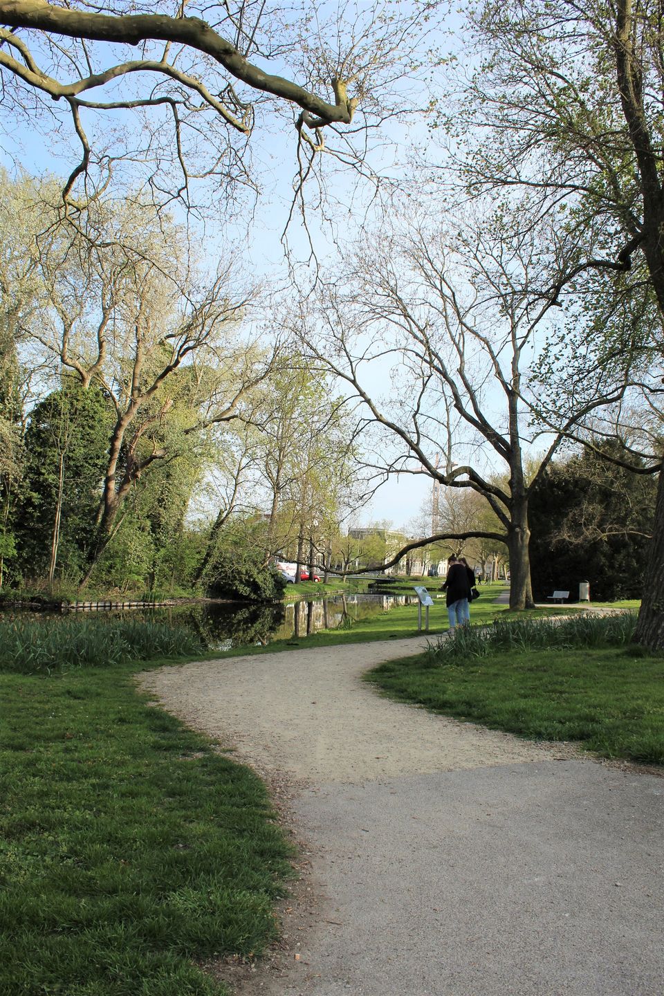
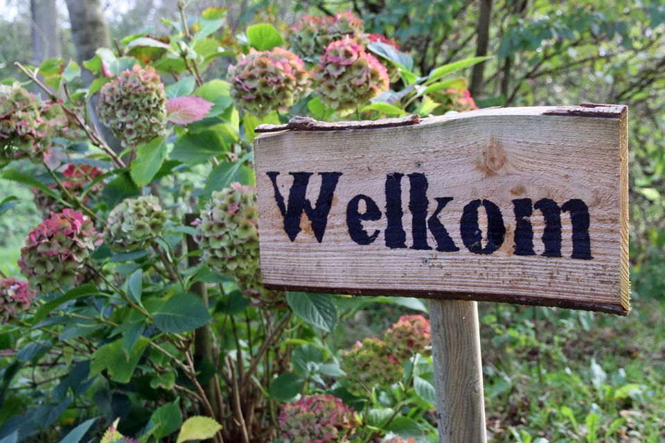
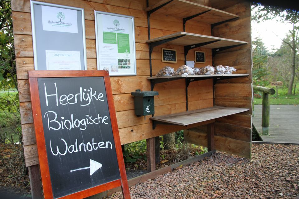
Beemster Arboretum
The Beemster Arboretum is a unique collection of plants and trees that can continue to grow until the end of days in a park-like environment in the Beemster.
Beemster Arboretum
The Beemster Arboretum is a unique collection of plants and trees that can continue to grow until the end of days in a park-like environment in the Beemster.
The Beemster Arboretum is the third largest collection of trees and shrubs in the Netherlands. The collection consists of 2600 species and varieties and the total number of trees and shrubs is around 6000 specimens. The total area of the arboretum is 7.5 hectares. The assortment list is available for inspection by interested parties. They are happy to provide information about the design of gardens and yards or advice about a particular tree or shrub.
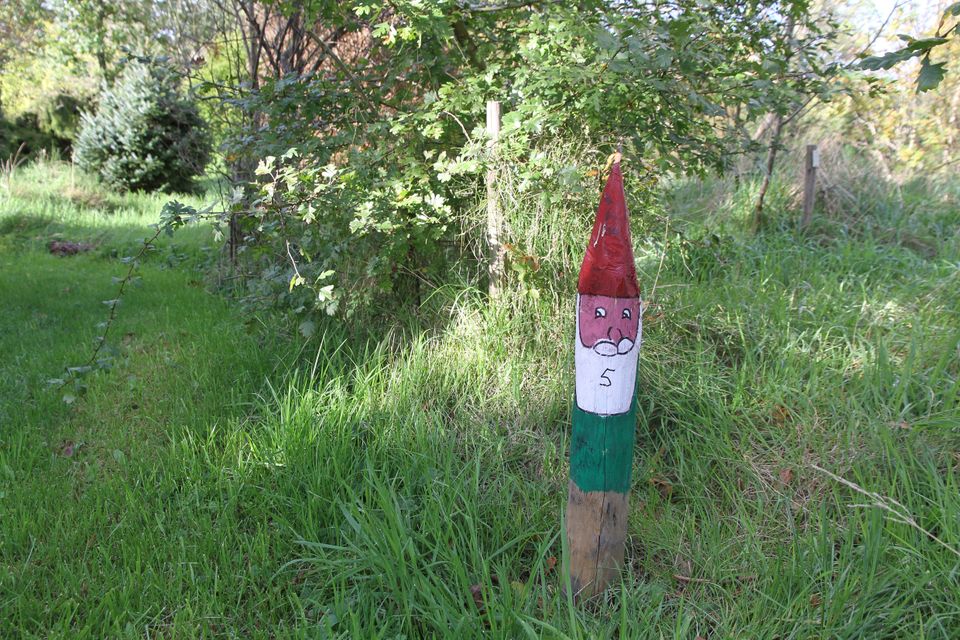
Tours
They regularly organize tours for groups. These must be requested in advance via 06-23746371 or beemsterarboretum@gmail.com. Lunch and/or coffee/tea can also be arranged.
children's parties
They also organize fun children's parties. Call or email for the wishes and possibilities.

- 78
- 77
- 49
- 76
Ook interessant
-
Werelderfgoed in het kwadraat
Werelderfgoed in het kwadraat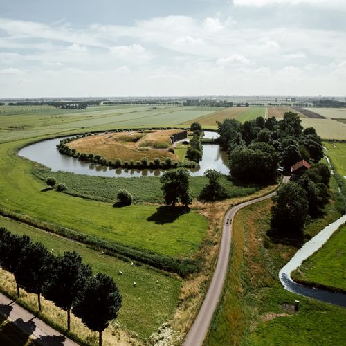
Deze wandelroute voert je door maar liefst twee werelderfgoederen: Droogmakerij...
(17.0 km) -
Beemster Bloesemwandeling
Beemster Bloesemwandeling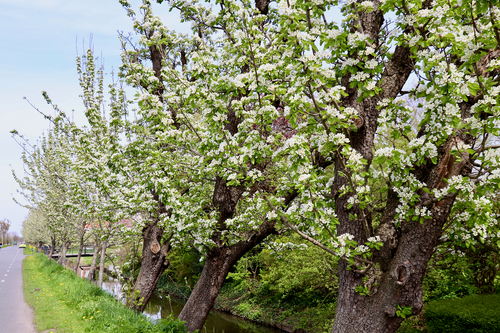
Deze wandeling laat je zien hoe mooi het in De Beemster is als de bloesems bloeien....
(11.0 km) -
Bukken voor golfballetjes
Bukken voor golfballetjes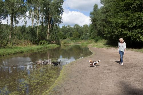
De bukken-voor-golfballetjes-route start aan de noordkant van het Purmerbos.
(8.5 km) -
Vurige Staartroute
Vurige Staartroute
Maak kennis met de smalle percelen van de oude polder De Vurige Staart en geniet...
(7.0 km) -
De frisse neuzenroute
De frisse neuzenroute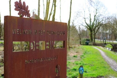
Een grote favoriet onder de wandelaar met hond. Op dit traject kan de hond lekker...
(5.0 km) -
Purmerlandroute
Purmerlandroute
Op deze route verken je het open Purmerland tot in de noordkop van recreatiegebied...
(12.5 km) -
Phoenixpad Purmerbos
Phoenixpad Purmerbos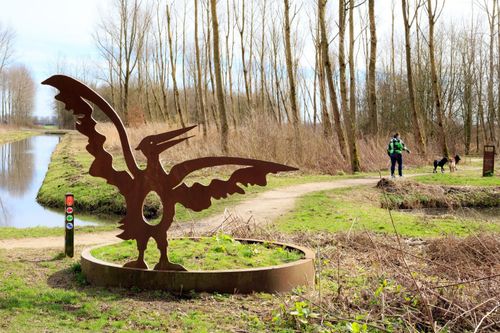
Het Phoenixpad is een ontwerp van beeldend kunstenares Mirjam Bakker, die een...
(4.0 km) -
Kabouterpad Purmerbos
Kabouterpad Purmerbos
Wist je dat er in het Purmerbos kabouters wonen? Ga jij mee op zoek naar ze?
(1.0 km) -
Op de kaart gezet | Wandelroute
Op de kaart gezet | Wandelroute
Deze wandelroute door De Beemster neemt je mee langs prachtige boerderijen,...
(15.0 km) -
Middeleeuws Sporenpad
Middeleeuws Sporenpad
In de oude polder Zeevang barst het van de sporen uit het verleden. Geniet tijdens...
(7.4 km)