


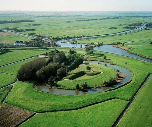
Stelling van Amsterdam Trail
An ingenious piece of Dutch water engineering, that is what you see on the Stelling van Amsterdam trail. Explore seven forts and a tangle of locks, dams, canals and dykes.
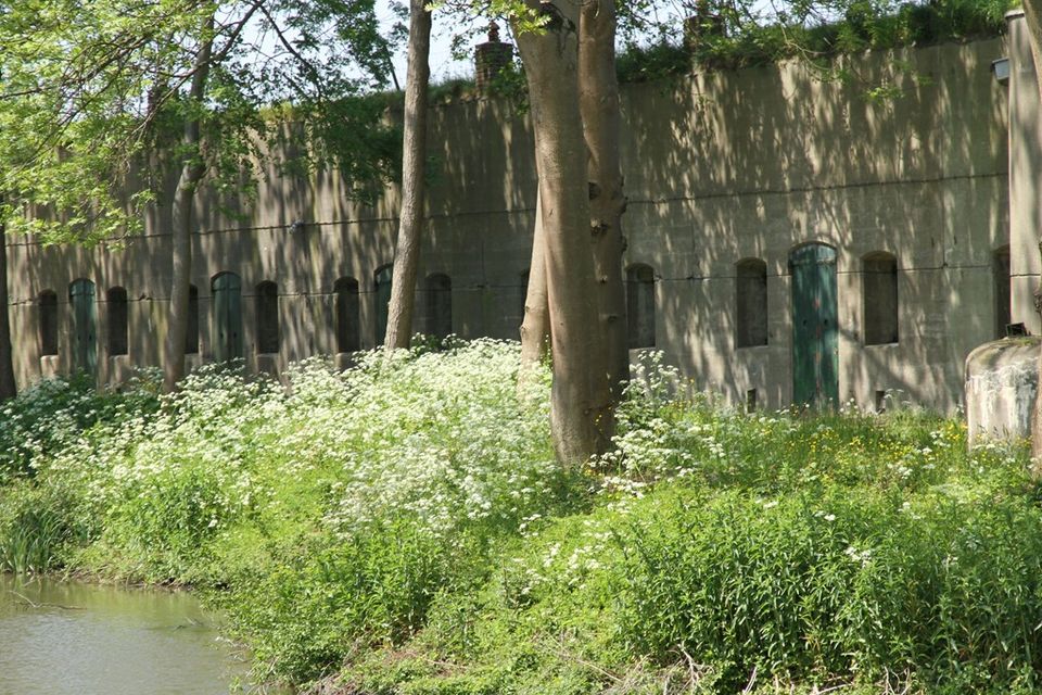
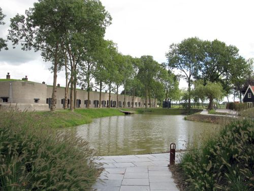
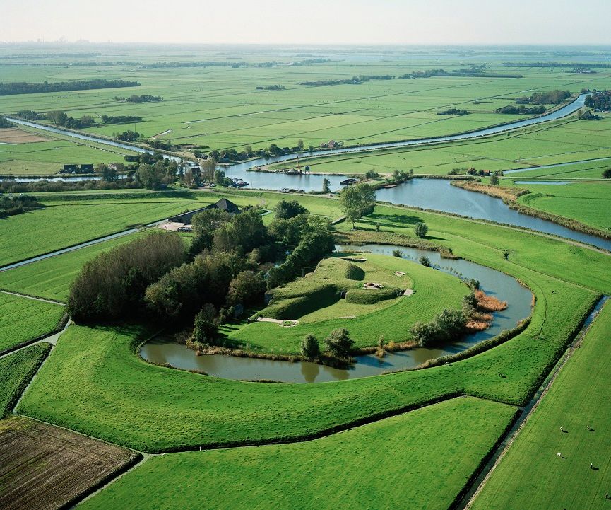
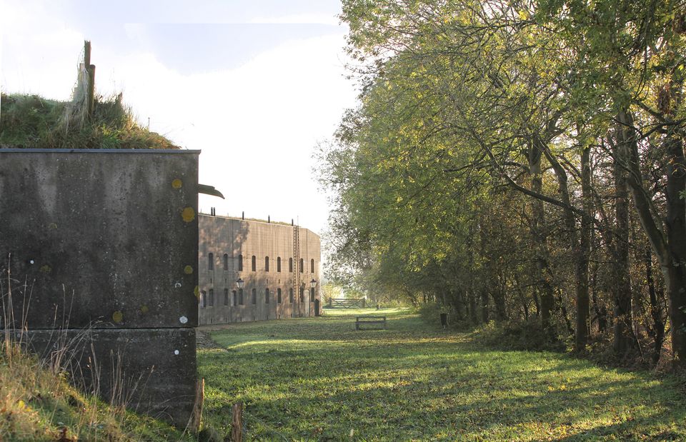
A harness for the capital, a place for the government and royal family to withdraw in times of war. That was the idea when, at the end of the nineteenth century, the National War Office decided to create a strip of between fifteen and twenty meters long as a defense line around Amsterdam. A soggy harness because when the enemy presented itself, access was prevented by flooding (inundating) large pieces of land
inside that strip. At the so-called accesses – places that could not be put under water - forts sprang up (42 in all) so that the enemy could not slip through here.
An ingenious piece of Dutch water engine…
A harness for the capital, a place for the government and royal family to withdraw in times of war. That was the idea when, at the end of the nineteenth century, the National War Office decided to create a strip of between fifteen and twenty meters long as a defense line around Amsterdam. A soggy harness because when the enemy presented itself, access was prevented by flooding (inundating) large pieces of land
inside that strip. At the so-called accesses – places that could not be put under water - forts sprang up (42 in all) so that the enemy could not slip through here.
An ingenious piece of Dutch water engineering, that is what you see on the Stelling van Amsterdam trail. Explore seven forts and a tangle of locks, dams, canals and dykes. And with a little imagination you can see the soldiers of the past keeping watch here. Because, since then the landscape has changed very little. For a long time building was forbidden within a radius of one kilometer of the Stelling and so nature has been able to show itself in all its exuberanc.
How it works
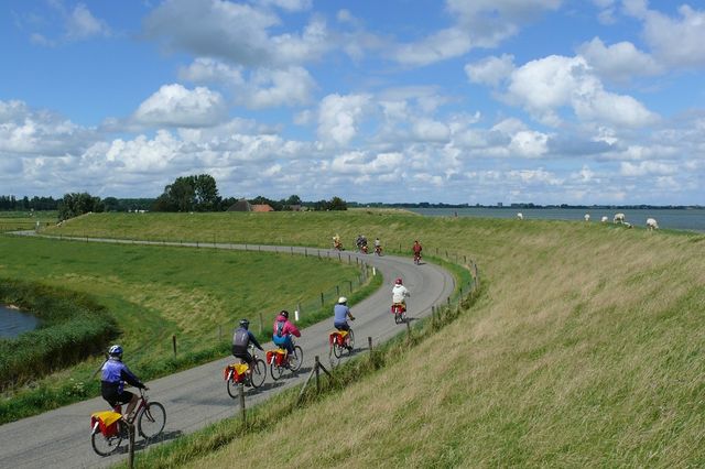
You cycle the trail with the help of the so-called junction system. A junction is a uniquely numbered spot where two cycle paths cross each other. The trails in this book are set out on the basis of these numbers. The only thing you have to do is follow the numbers in the sequence in which they are presented. You can recognise the junctions by the green and white signs along the way.
How do I get there?
Public transportation from Amsterdam CS. Bus line 314 in the direction of Hoorn. Get off at 'Bus station Edam'.
From the bus stop to the bicycle rental: Walk in the direction of restaurant Hof van Holland. Walk over the bridge and take a right onto the Lingerzijde. Follow the road to the left and stay on the Lingerzijde, this road leads to the Kleine Kerkstraat. Take a right at the end of this street onto the Spuistraat and right away take left to the Spui. Take the first street to the left onto the Grote Kerkstraat. After one minute you'll see the bicycle rental on your left.
From the bicycle rental to the first junction: Return to the restaurant Hof van Holland. On this streetcorner you will find junction 95.
Neem alvast een kijkje
Dit ga je zien
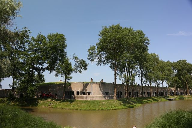
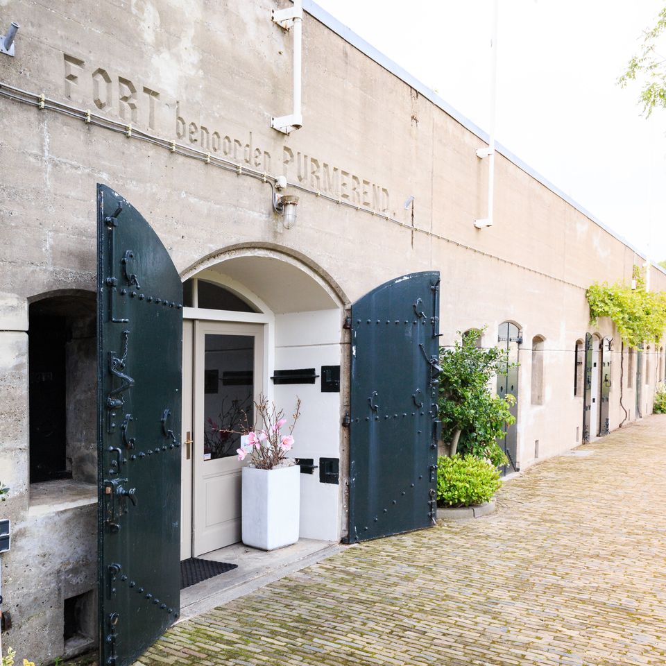
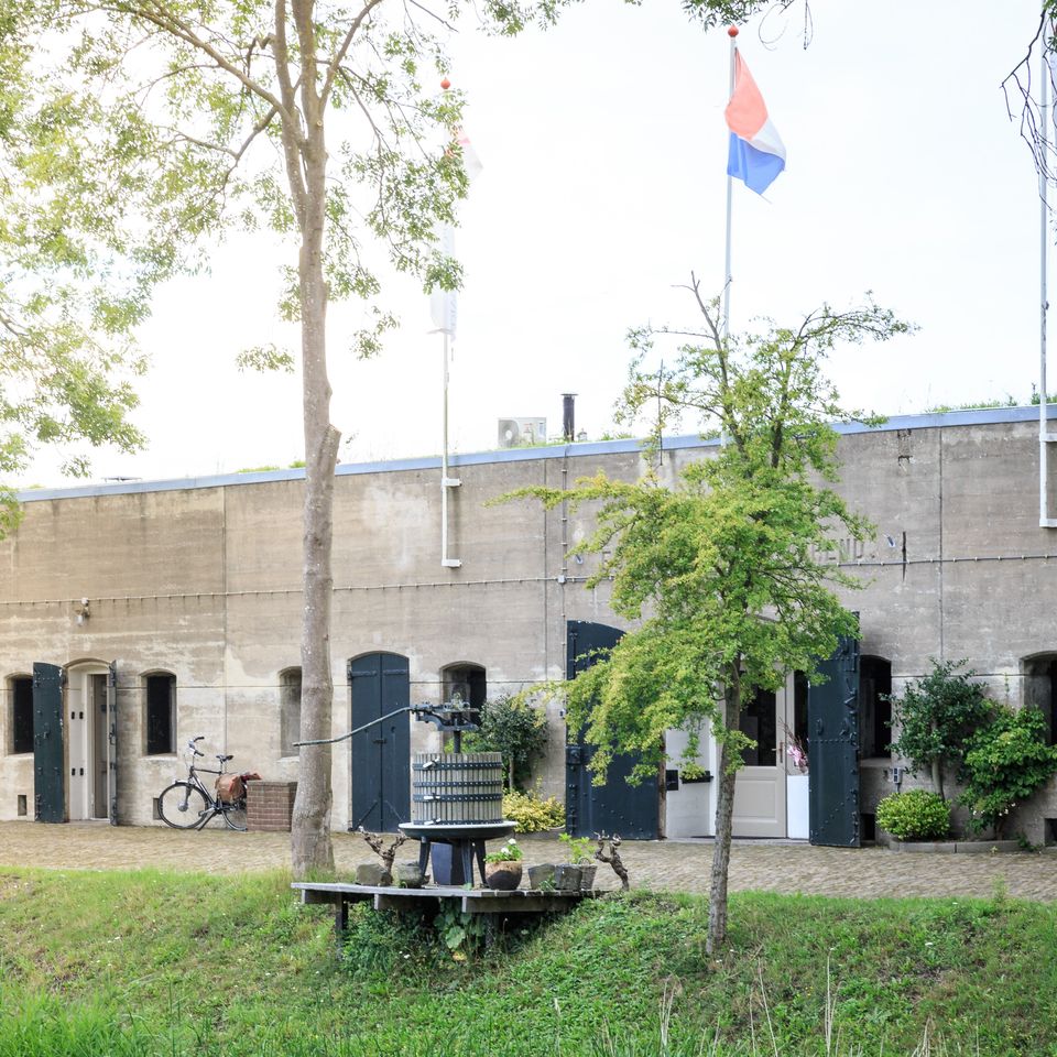
Fort Benoorden | Purmerend
Fort Benoorden is onderdeel van de Stelling van Amsterdam en valt onder het UNESCO Werelderfgoed 'Hollandse Waterlinies’. Deze verdedigingslinie van forten werd tussen 1880 en 1914 aangelegd op 15 tot 20 kilometer rondom Amsterdam.
Fort Benoorden | Purmerend
Fort Benoorden is onderdeel van de Stelling van Amsterdam en valt onder het UNESCO Werelderfgoed 'Hollandse Waterlinies’. Deze verdedigingslinie van forten werd tussen 1880 en 1914 aangelegd op 15 tot 20 kilometer rondom Amsterdam.
Binnen deze ring konden het leger, de regering en de koning zich terugtrekken bij (mogelijke) aanvallen op Nederland. Via een ingenieus systeem kon het land rondom de verdedigingslinie onder water worden gezet. Te ondiep voor boten en te diep voor man en paard. Vijf forten en een inundatiesluis van deze verdedigingslinie liggen in De Beemster.
Dit fort werd aangelegd ter verdediging van de kwetsbare punten gevormd door de Beemsterringdijk, Purmerenderweg en Rijperweg. Het verdedigbaar aardwerk was in 1895 gereed. Het bomvrije hoofdgebouw uit 1912 is door overdekte gangen met de twee hefkoepelgebouwen verbonden. Tegenwoordig worden er tussen de dikke muren van dit fort wijn opgeslagen, want sinds 1981 is hier een wijnimporteur gevestigd.
Het fort benoorden Purmerend werd pas in een laat stadium (1907) aan de Stelling van Amsterdam toegevoegd. Bij de bouw van dit fort, dat onderdeel uitmaakt van het noordelijke front van de Stelling, maakte men gebruik van aantal nieuwe inzichten. Een van de noviteiten die men toepaste was de aanleg van zogeheten poternes - met staal en beton overdekte gangen - die een geheel veilige verbinding vormden tussen het hoofdgebouw en de geschuteenheden.
Er werden poternes aangelegd naar de twee hefkoepels, waarin de grote geschutstukken stonden opgesteld en naar de mitrailleurstellingen die aan het voorfront waren opgesteld. Aan de rechterkant van het front van het fort is een deel van het terrein afgegraven. Dat is gebeurd toen er een nieuwe toegangsweg werd aangelegd.

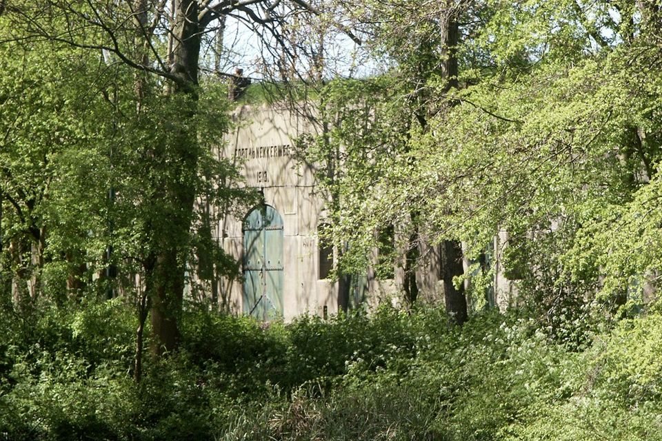
Fort aan de Nekkerweg
Het fort aan de Nekkerweg is onderdeel van de Stelling van Amsterdam en valt onder het UNESCO Werelderfgoed 'Hollandse Waterlinies’. Deze verdedigingslinie van forten werd tussen 1880 en 1914 aangelegd op 15 tot 20 kilometer rondom Amsterdam.

Fort aan de Nekkerweg
Het fort aan de Nekkerweg is onderdeel van de Stelling van Amsterdam en valt onder het UNESCO Werelderfgoed 'Hollandse Waterlinies’. Deze verdedigingslinie van forten werd tussen 1880 en 1914 aangelegd op 15 tot 20 kilometer rondom Amsterdam.
Dit fort zorgde voor een knik in de hoofdverdedigingslinie. Om te voorkomen dat de Zuidoostbeemster bij inundatie van de Beemsterpolder onder water zou komen te staan, werd zowel de Nekkerweg als de Volgerweg opgehoogd. Dit fort moest voorkomen dat de vijand zich gemakkelijk via deze twee verhoogde wegen kon verplaatsen.
Het Fort aan de Nekkerweg werd pas in 1912 opgeleverd. Het fort kreeg vrijwel direct daarna al een andere bestemming. In 1918 werd het in gebruik genomen als militaire gevangenis. In de periode daarna hebben hier vooral veel dienstweigeraars hun straf uitgezeten. Van het oorspronkelijke interieur van het fort is vrijwel niets over. Wel zijn de betonnen mitrailleuropstellingen op de frontwal redelijk intact gebleven alsmede de fortwachterswoning.
Het fort waar vroeger soldaten gevestigd zaten, is nu omgetoverd tot een luxe eco-chic welness resort, met twee restaurants en 16 luxe kamers en suites.
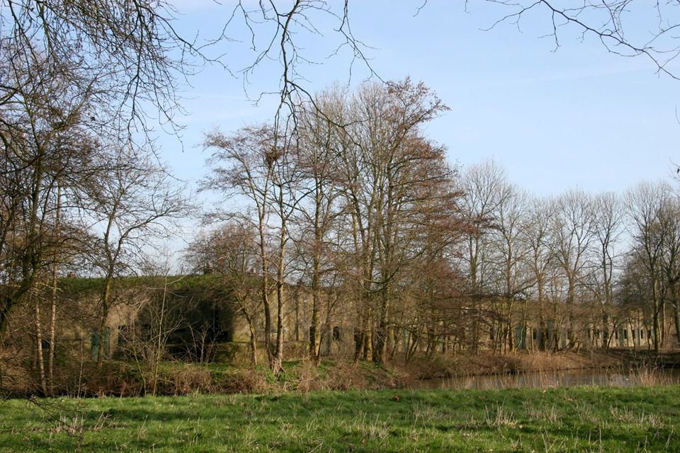
Fort bij Spijkerboor
Het fort bij Spijkerboor was het belangrijkste fort in het noordelijke front van de Stelling van Amsterdam. Van hieruit werden de zeer strategische dijken rond de Beemsterringvaart en het Noord-Hollands kanaal verdedigd.
Fort bij Spijkerboor
Het fort bij Spijkerboor was het belangrijkste fort in het noordelijke front van de Stelling van Amsterdam. Van hieruit werden de zeer strategische dijken rond de Beemsterringvaart en het Noord-Hollands kanaal verdedigd.
Fort bij Spijkerboor werd dan ook uitgerust met het zwaarste geschut van alle forten in dit deel van het front. Aan de voorzijde werd zelfs een draaibare pantserkoepel aangebracht met twee stuks geschut van 10,5 centimeter kaliber met een bereik van maar liefst tien kilometer. Deze koepel en het geschut zijn nog aanwezig en kunnen ook bezichtigd worden.
Het fortgebouw van twee verdiepingen is na de eerste wereldoorlog een aantal keer als gevangenis gebruikt. Uit die periodes stammen de tralies voor de ramen en ook de wandschilderingen in het interieur.
Let op: Fort bij Spijkerboor blijft het seizoen van 2024 gesloten.
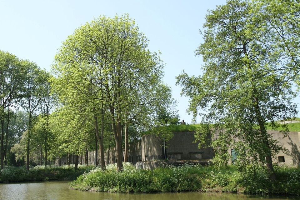
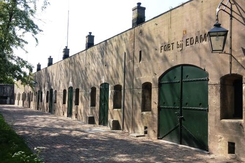
Fort bij Edam
Het Fort bij Edam is onderdeel van de Stelling van Amsterdam, deze stelling is onderdeel van UNESCO werelderfgoed de Hollandse Waterlinies, en werd als één van de laatste forten ontwikkeld voor deze unieke verdedigingslinie.


Fort bij Edam
Het Fort bij Edam is onderdeel van de Stelling van Amsterdam, deze stelling is onderdeel van UNESCO werelderfgoed de Hollandse Waterlinies, en werd als één van de laatste forten ontwikkeld voor deze unieke verdedigingslinie.
Het Fort bij Edam is, vergeleken met veel andere forten binnen de Stelling van Amsterdam, een relatief modern type fort. Het fort onderscheidt zich van de oudere typen door het gebruik van (deels) gewapend in plaats van ongewapend beton. Tegelijkertijd heeft het fort nog een paar andere opvallende afwijkingen ten opzichte van het zogenaamde B-type. Zo zijn er in Edam geen korte zijfronten met hefkoepels. En het mitrailleurblok voor het voorgebouw heeft in Edam plaatsgemaakt voor een pantserkazemat. Deze kazemat was door middel van een met beton en staal overdekte gang verbonden met het hoofdgebouw (een zogeheten poterne). In het hoofdgebouw is vooral in de keuken nog veel van de originele inhoud aanwezig, waaronder de grote kookketels en de boilers.
Het fort kan zowel mét als zónder begeleidende gids worden bezocht. Echter niet alle delen van het fortgebouw en het fortterrein zijn voor bezoekers toegankelijk. Dit staat met aanwijzingsborden, hekken en touwen aangegeven. Bovendien ligt het fort in een beschermd natuurgebied van Staatsbosbeheer. Aan bezoekers wordt daarom verzocht de rust die er heerst te respecteren en de aanwijzingen van de vrijwilligers op te volgen. Meer weten? Ga dan naar de website van het Fort bij Edam.
- 95
- 94
- 28
- 04
- 05
- 46
- 49
- 25
- 43
- 60
- 61
- 06
- 07
- 08
- 09
- 11
- 10
- 63
- 64
- 97
- 95
Ook interessant
-
Under Sea Level Trail
Under Sea Level Trail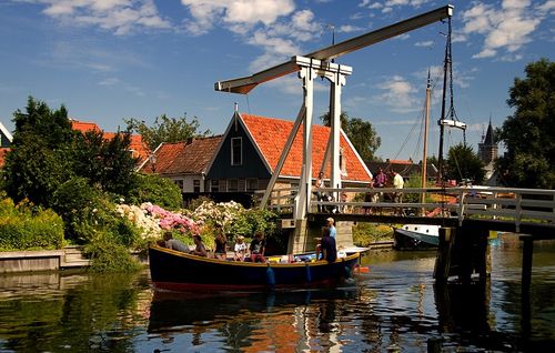
Cycling below sea level? Many people don’t dare think about it, they’re afraid...
(36.7 km) -
Traditional Costume Trail
Traditional Costume Trail
The Traditional Costume Trail is a varied bike route where you cycle through...
(41.0 km) -
Water Trail
Water Trail
Starting from Amsterdam, you will be surprised at how suddenly the city becomes countryside....
(45.0 km) -
Monument Trail
Monument Trail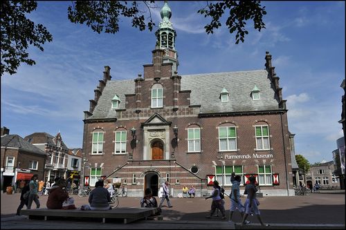
Although this is called the Monument Trail you will also come across plenty...
(40.0 km) -
Windmill Trail
Windmill Trail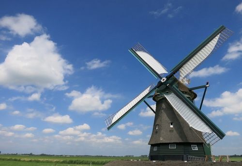
The Windmill Trail is a bike tour that takes you over old sea beds. Yes, that’s...
(55.0 km) -
Rural Amsterdam
Rural Amsterdam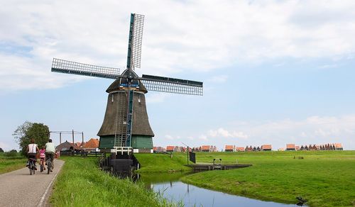
Want to escape the city for a while? Not in the mood for hustle and bustle?...
(45.0 km)