
The Secret of the Beemster Windmills
Following the exhibition "Het Geheim van de Beemster Molens", a route has been set up that passes by the old mill galleries. Not as it was centuries ago, as the windmills are unfortunately no longer there, but of what is still visible today.
The route runs along the Beemsterringdijk and through De Beemster. You’ll pass places where mill lanes once stood and visit Purmerend, with which Beemster has had a connection ever since the land was reclaimed. As there were no buildings in the newly reclaimed land at the time, the Hoofdingelanden would often use Purmerstein Castle in Purmerend for large gatherings.
The route is approximately 48 km long and you can organise it as you see fit.
Important information:
- The booklet ‘The Secret of the Beemster Windmills’, which includes the route, is available free of charge from the Beemster Visitor Centre.
- This is a joint project between Visit Beemster and the Beemster Museum.
You are going to see this
-
Starting point:
Beemster Visitor Centre
Middenweg 185
1462 HJ Middenbeemster
Navigate to starting point -
04
-
46
-
43
-
60
-
07
-
32
-
09
-
Four Draaioorder windmills | Beemster Windmills
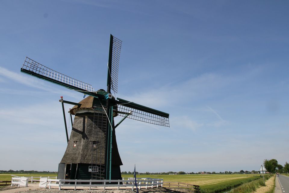
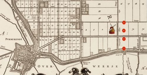
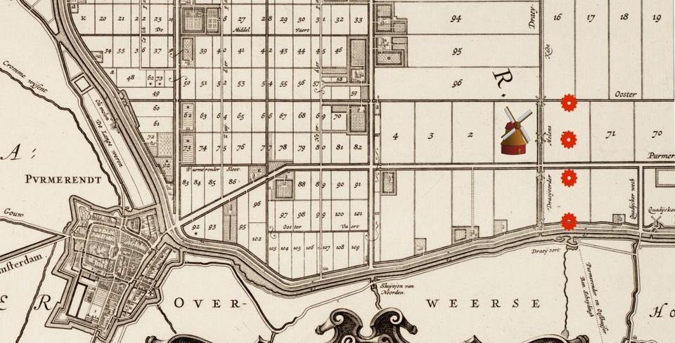
On old maps and in texts, this area is called 'Draaij oort'. At this place, when the Beemster was still a lake, ships could possibly turn here. Mills were built here during the reclamation.
Four Draaioorder mills | Beemster MillsFour Draaioorder mills | Beemster Mills
On old maps and in texts, this area is called 'Draaij oort'. At this place, when the Beemster was still a lake, ships could possibly turn here. Mills were built here during the reclamation.
Demolition and rebuilding
There were two mills at Draaioord. When the Purmerender mills were demolished, one of the two was placed here. In 1632, the Hoofdingelanden (the administration at the time) decided to drastically improve drainage and install a four-stage drainage system here (mill race with four mills behind each other). A fourth mill was added, mill no. 2 in the mill corridor.During the construction of the slip road on the N244 to Oosthuizen in 2017, remains of this mill corridor and indeed of the second and last mill built emerged. This gave archaeologists an insight into the location of the mill yard and mill life. There were four octagonal upper windmills at Draaioord as part of a total of 50 mills that kept the water level in the polder. Mill number 2 stood below the slip road. If you want to know more, see North Holland archaeological publications.
Poverty on a Draaioorder mill
Life on a mill was hard and things did not always go well. The message below was communicated to the board:On 9 June, the dike reeve reports on the working visit the chief polder masters made to the Draaioorder mills. The family of miller Adriaan Kruyt at one of the mills was in very poor circumstances. After discussion, it is decided to help Kruyt find a job in the East or West Indies. The children go to the orphanage and the youngest is placed with a family - a 'social' solution anno 1722.
-
-
04
-
Beemster Gate | Beemster Mills
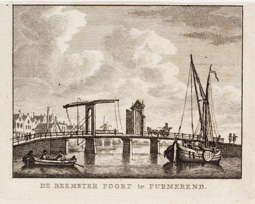
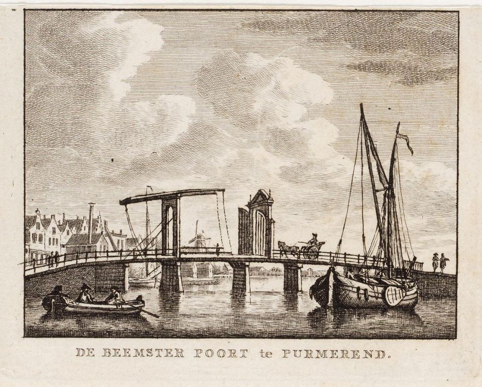
When the Beemster lake was drained, some problems arose such as access to the new land. You could only cross the wide ring canal by boat, which is why bridges were at the top of the surrounding villages' wish lists.
Beemster Gate | Beemster MillsBeemster Gate | Beemster Mills
When the Beemster lake was drained, some problems arose such as access to the new land. You could only cross the wide ring canal by boat, which is why bridges were at the top of the surrounding villages' wish lists.
After tough negotiations, these appeared in several places. Usefulness and necessity, but above all who pays for it, were important questions. In August 1610, the 'commissioners of the Beemster and the Lords of Purmerende' reached an agreement that a bridge would be made over the ring canal. They called it the Beemster Gate.
-
-
Purmerend Market Town | Beemster Windmills
Until the Beemster Lake was drained, the people of Purmeren fished the lake and the Where. The eel caught there was of fine quality and a good sales product. With the reclamation of the lake, the fishing water had become considerably smaller and the life of the fishermen changed.
Purmerend Market Town | Beemster WindmillsPurmerend Market Town | Beemster Windmills
Until the Beemster Lake was drained, the people of Purmeren fished the lake and the Where. The eel caught there was of fine quality and a good sales product. With the reclamation of the lake, the fishing water had become considerably smaller and the life of the fishermen changed.
The rise of agriculture and livestock farming
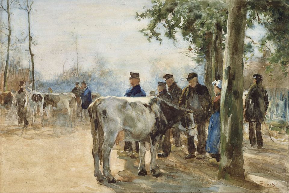
Agriculture and livestock farming flourished on the new land. As Purmerend already held market rights, it developed into a market town. The cheese and butter market, and later the cattle market, were renowned throughout the wider region. A lively trade in cows, sheep and chickens flourished, and all manner of goods were on sale at the general market – from pots and pans to plants, fabrics, fruit and vegetables. This general market still exists today, whilst the other markets have disappeared.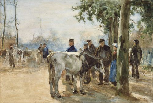
-
-
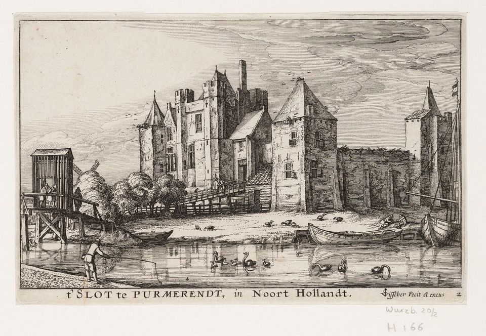
Purmerstein Castle | Beemster Windmills
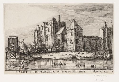
Only the name ‘Slotplein’ and a few remnants of the walls still remind you of the time when a castle stood here. In 1410, Purmerstein Castle was built here on the orders of Willem Eggert; it was larger than Muiderslot Castle.
Purmerstein Castle | Beemster WindmillsPurmerstein Castle | Beemster Windmills
Only the name ‘Slotplein’ and a few remnants of the walls still remind you of the time when a castle stood here. In 1410, Purmerstein Castle was built here on the orders of Willem Eggert; it was larger than Muiderslot Castle.
In 1410, Purmerstein Castle – larger than Muiderslot – was built here on the orders of Willem Eggert. The castle, often referred to simply as ‘Kasteel’, experienced a turbulent period as a centre of power. The image shows a sturdy castle, though its walls were not capable of withstanding cannon fire. According to the builder, this was not necessary. In 1741, the town council of the time ordered the castle – seen as a hated symbol of power – to be demolished.
Allotment of the plots
On 30 July 1612, the bell was rung at 12 noon to announce the allotment of the Beemster lands. The meeting of the Hoofdingelanden took place at the ‘Kasteel’ in Purmerend. At their request, the aldermen of Purmerend were also present to record the parcelling.At the door, dike warden Tobias de Coene read out the 'lot conditions' to the stakeholders and interested parties present. Following this, the raffle of the Beemst lands among the investors took place. Everything was minutely recorded in the 'Extract Uyt het Octroy van de Beemster met de Cavel-Conditien en de Kaerte van dien als mede 't Register van de Participanten Beemster tot Purmerende'.
For many years, the Beemster board met in the Castle or Slot Purmerstein because no suitable location was yet available in the new polder.
-
-
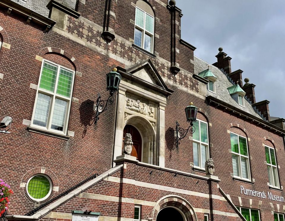
Purmerends Museum & Zuiddijk | Beemster Windmills
Here you will find lots of information about the history of Purmerend: about the castle, the consequences of the draining of the Beemster, Purmer and Wormer, the development from fishing village to market town.
Purmerends Museum & Zuiddijk | Beemster MillsPurmerends Museum & Zuiddijk | Beemster Mills
Here you will find lots of information about the history of Purmerend: about the castle, the consequences of the draining of the Beemster, Purmer and Wormer, the development from fishing village to market town.
You’ll find early works by several architects born in Purmerend, such as J.J.P. Oud, Mart Stam and Jac. Jongert. The museum has a fine collection of Purmerend pottery from the period 1896–1907, produced by the factories Wed. N.S.A. Brantjes & Co, NV Haga, L. Huisenga and Jb Vet & Co.
Curious? Take a virtual tour of the museum. The museum shop also houses the tourist information centre, where staff will be happy to provide you with further information.
Continue your route along the Zuiddijk at the Beemsterbrug.
Tender for dyke works and fishing licences
Through posters setting out the conditions for the work, the Hoofdingelanden are seeking labourers for the section of dyke to be constructed near Purmerend. Leeghwater writes:‘On 10 April 1608, amidst great public interest at the Castle, the contract for the dyke section was awarded to Jan Adriaansz Jongkind van Burghorn. As he had been the first to mine the first section, he was rewarded with a barrel of beer.’
Following the reclamation, the fishermen had lost much of their fishing grounds and the open waterways had fallen into disrepair. This hampered shipping. Surrounding villages requested permission to fish in the ring canal. In 1656, the town of Purmerend and the Hoofdingelanden of Beemster reached an agreement regarding fishing in the ring canal between Draaioord and the southern end of the Wormerweg. This was permitted subject to strict conditions. For instance, fishermen were not allowed to damage the ring dyke, obstruct water discharge or hinder shipping, all on pain of a fine.
Zuidijk at No. 14
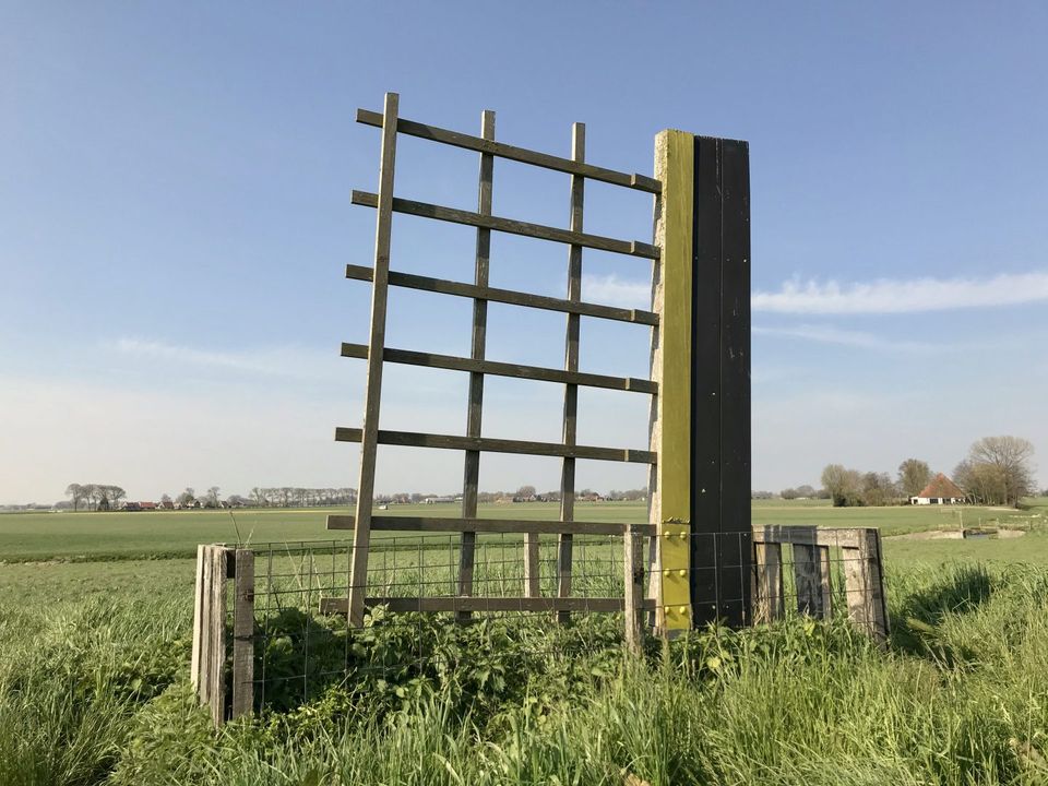
There is a large floodgate in the Zuiddijk. This forms part of the UNESCO World Heritage Site ‘The Dutch Waterlines’ and was constructed between 1890 and 1891. The floodgate was used for ‘flooding the Beemster’. More information can be found on the sign, and you can walk down to the sluice chamber. Please note: close the gate, as there may be sheep in the area.
Zuiddijk at no. 13
This is one of the loading points at the loading sites along the ring canal where, amongst other things, livestock was loaded onto boats for transport to the market. This place is therefore called ‘de Dood’ (the Death), as the livestock was usually taken away for slaughter. The farm across the way also bears this name.
Zuiddijk 13
This is where the Fort on Middenweg is situated, part of the UNESCO World Heritage Site ‘The Dutch Waterlines’. Unfortunately, you cannot visit it. However, the fort and its moat are clearly visible from the dyke.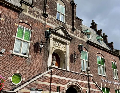
-
-
The Jisper mill corridor | Beemster Mills
The Jisper molengang has been a three-stage mill corridor from the reclamation of the Beemster until the demolition of the mills.
The Jisper molengang | Beemster MolensThe Jisper molengang | Beemster Molens
The Jisper molengang has been a three-stage mill corridor from the reclamation of the Beemster until the demolition of the mills.
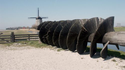
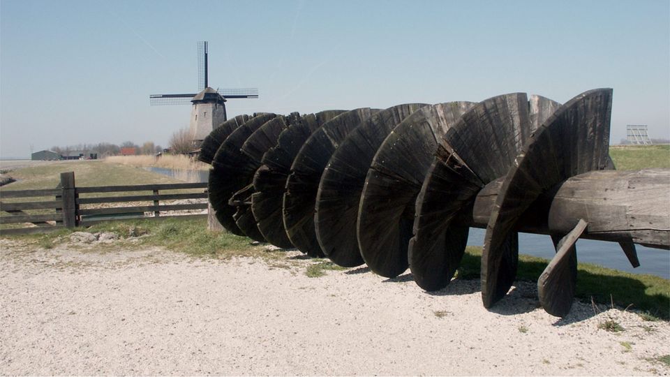
Here the lake was less deep so this combination was sufficient. At Zuiddijk no 4, traces of the former mill corridor can still be seen on either side of the farm. Three mills in a row, first with a scoop wheel and later with an auger, fed the water to the ring canal. The lifting range of a scoop wheel (1.50 m) was less than that of the later Archimedes screw or auger (up to 4.50 m). From 1848, the Beemster mills were given an auger.
-
-
The Spijkerboordergat | Beemster Windmills
Along the 'shortcut' you drive onto Spijkerboor. The Spijkerboordergat was then an erratic wild water and difficult to contain.
The Spijkerboordergat | Beemster MillsThe Spijkerboordergat | Beemster Mills
Along the 'shortcut' you drive onto Spijkerboor. The Spijkerboordergat was then an erratic wild water and difficult to contain.
Now it is a lovely stopping place with a marina, the Jan Hop ferry to sail across and the Fort near Spijkerboor. (The shortcut was the vegetation-covered road from the Fort near Spijkerboor to the North Holland Canal).
The storyResidents of the Beemster, such as fishermen, farmers and landowners, watched the reclamation with sorrow. The newly constructed dyke was breached and a prohibition plaque was issued. Enforcement had to be strict and fines or forfeiture could result if the rules laid down were broken.'
Leeghwater writes: 'After the dike breach, the Spijkerboordergat had to be closed. The strong current created additional difficulties, the sides slapped away. With piling, beams between which soil was thrown, a dam was made.'
On 30 July 1610, the dykes decided not to further repair the old dike and to build a new one across the land of De Rijp . According to the accountants, this would be cheaper. A new dike would cost fl 24,704, while repairing the old one would cost fl 24,300. The advantage was that the new ring ditch and dike would be built on the 'old' land, on a firmer foundation.
-
-
Three mill galleries and a sloping ditch | Beemster Mills
Volger or Spijkerboorder mill corridor
Three mill strakes and a sloping ditch | Beemster MillsThree mill strakes and a sloping ditch | Beemster Mills
Volger or Spijkerboorder mill corridor
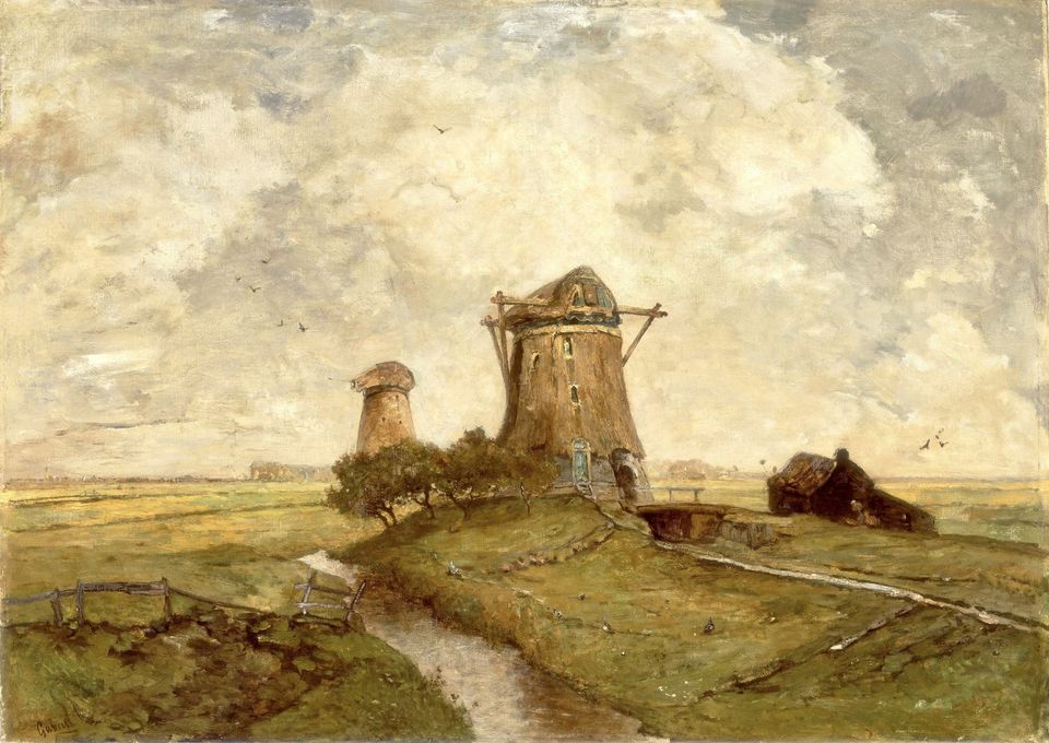
Mills were the LEGO 'avant la lettre'. Building kits, you could quickly tear them down and rebuild them elsewhere. Consequently, when the Beemster was reclaimed, the mills were moved several times because drainage required it. The wide green path by the fence between the fort at Spijkerboor and Westdijk no 45 is still a remnant of this mill corridor.
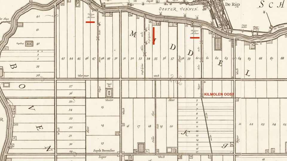
Grafterdijker and Rijper mill corridor
These two mill corridors stood a short distance apart. Farm de Molenkolk, near Westdijk no 38, stands where the Graftdijker mill corridor once stood.
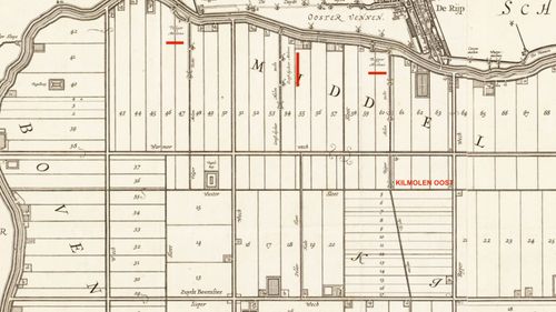
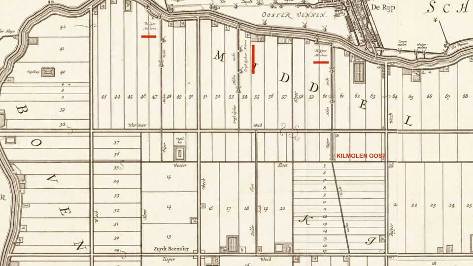
The sloping ditch and kilmill
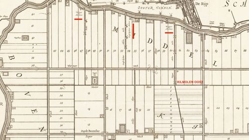
De Rijper molengang, near Westdijk no. 34, caused the dykes quite a few headaches. Water management did not work well here. The middle of the Beemster was extra deep and the mill stood along a block of small north-south running plots. The water here had to make several right angles to reach the mill which did not work well. A sloping ditch was dug through these plots so that water drainage improved. A small mill from the Spijkerboordergang was moved here. You can still see the watercourses of the Rijper molengang in the landscape.
The bridge at De Rijp
When the Beemster Lake was drained, the Rijpers were deprived of their livelihood: fishing. Early on in the reclamation they demanded a bridge, but det lasted until April 1615. Even the high visitors with the princes had to enter the Beemster over a makeshift construction.
Leeghwater writes:
"The Heeren Hoofdingelanden invited Prince Maurits and his brother to a banquet in the Beemster to view the successful embankment. The roads in the new polder were reasonably passable and, on 4 July 1612, Princes Maurice and Frederik Hendrik visited. The party had arrived in De Rijp a day before, where they were welcomed by Jan Sijpersz. who had a beautiful young lady (a pretty spinster) with him. He gave both princes a gold coin.As there was not yet a bridge across the ring ditch at De Rijp , skipper Jan IJsbrands arranged for a 'bridge' to be built. With barges, prams and planks, he ensured a crossing with dry feet for the princes and their company."
-
-
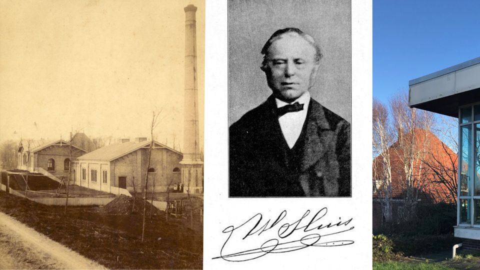
Wouter Sluis pumping station | Beemster Mills
On your way to the Wouter Sluis pumping station, you will see a beautiful white building on the other side of the ring canal, the former pumping station at De Rijp. It was built in 1874 and was fitted with a steam engine.
Wouter Sluis pumping station | Beemster MillsWouter Sluis pumping station | Beemster Mills
On your way to the Wouter Sluis pumping station, you will see a beautiful white building on the other side of the ring canal, the former pumping station at De Rijp. It was built in 1874 and was fitted with a steam engine.
This pumping station was named after Beemsterling Wouter Sluis (1827-1891); cattle farmer, inventor and administrator. It is one of two pumping stations that regulate the water level in the Beemster. Nowadays with far fewer gauge sections than before. Water control today means accepting a higher level in wet times and a lower level during drought.
In 1971, the old 1885 steam pumping station was replaced and a new pumping station received two pumps and electric motors. The pumping station can move 352 km³ of water per minute.
Between the old and the new land
On the Westdijk at the turnoff to the Hobrederweg, you see everything in one view: the old land the Eilandspolder (the former Schermer Eylandt) the ring canal, the ring dyke and the tightly divided landscape of the Beemster. Cycling down Hobrederweg you have almost all the features of the Beemster landscape together. The rows of trees, accurately mapped in the 17th century, the flat land and the geometric layout with the plots and ditches.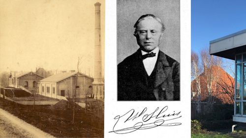
-
-
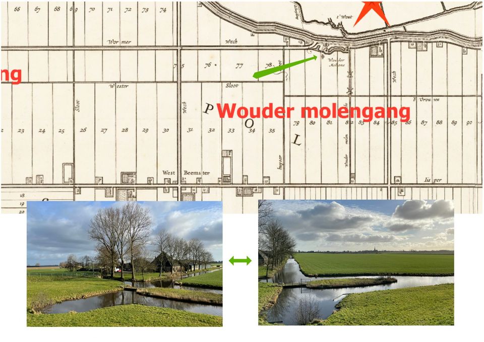
Wouder molgengang | Beemster Mills
The name for this mill corridor is derived from an area on the Schermer Eylandt, 't Wout on the westzijde side of ring ditch.
Wouder molgengang | Beemster MillsWouder molgengang | Beemster Mills
The name for this mill corridor is derived from an area on the Schermer Eylandt, 't Wout on the westzijde side of ring ditch.
Wedged in between the Schermer and the Beemster is a primeval Dutch low moorland nature reserve with rich flora and fauna. Nothing can be seen of 't Wout anymore. Standing on the Westijk, you can still see the waterways of the vanished mill race in the Beemster polder landscape.
Costs of maintenance and wages
It is 1615 and the board is keeping a close eye on the cost of work on the mills. They decide to stop outsourcing the carpentry work on the mills and have it done by their own carpenters. One of these is Pieter Cornelisz., carpenter on the Westdijk for nine mills, including for the mills here at 't Woud. The daily wage is then also set: for the bosses in summer 22, in winter 18 pennies and for the servants at 20 and 16 pennies.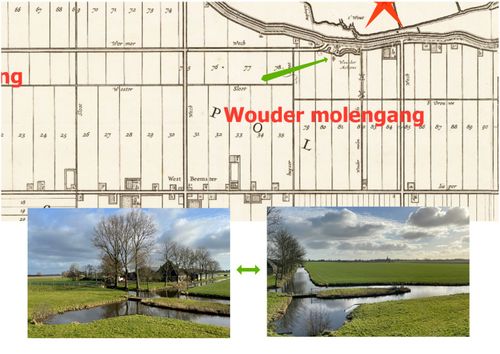
-
-
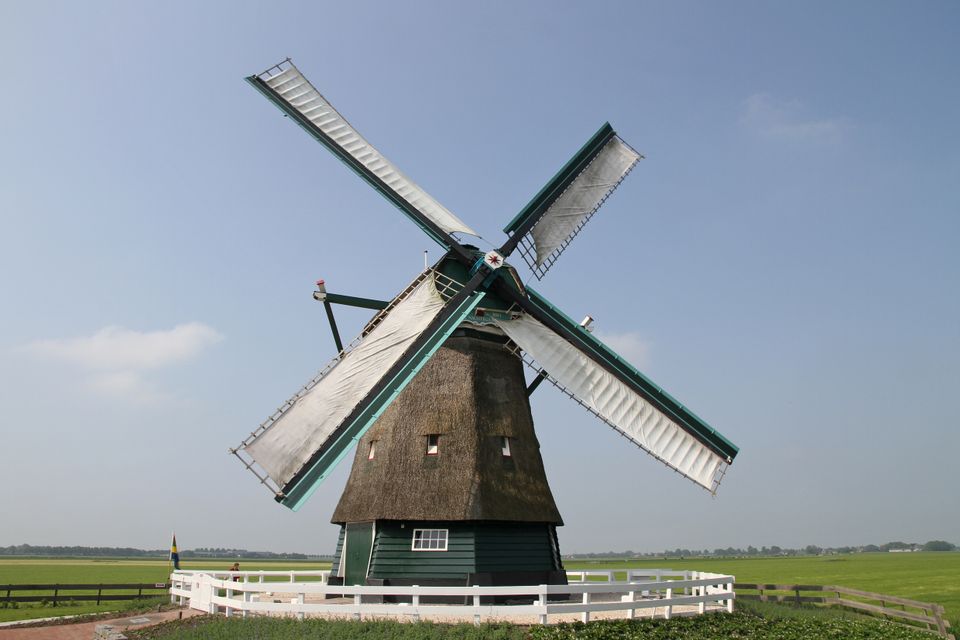
Corn mill The Nightingale
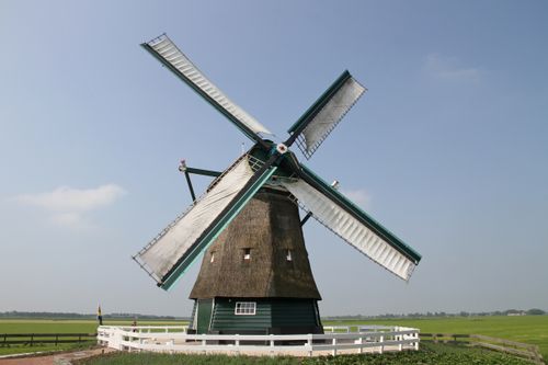
After De Beemster was reclaimed in 1612, the intention was to build five corn mills in the reclamation area. It ended up being one.
Corn mill The NightingaleCorn mill The Nightingale
After De Beemster was reclaimed in 1612, the intention was to build five corn mills in the reclamation area. It ended up being one.
This octagonal ground-sailer, also known as an octagonal outcrosser, was probably built in 1669. The mill has been moved several times. In October 2013, after the mill was moved again a few years earlier, restoration was completed.
-
-
Kilmolen het Meercatje | Beemster Mills
To improve the local drainage, the board buys land from Sr. Jan Fransz. Van der Lee to place a watermill here.
Kilmill het Meercatje | Beemster MolensKilmill het Meercatje | Beemster Molens
To improve the local drainage, the board buys land from Sr. Jan Fransz. Van der Lee to place a watermill here.
Michiel Poppen, the treasurer, pays him fl. 289 so that a millrace and mill yard can be built at mill het Meercatje (Meerkatje) on plot 82.
The mill was one of the small mills of the cleared Spijkerboorder corridor. After 1971, the mill ditch was drained.
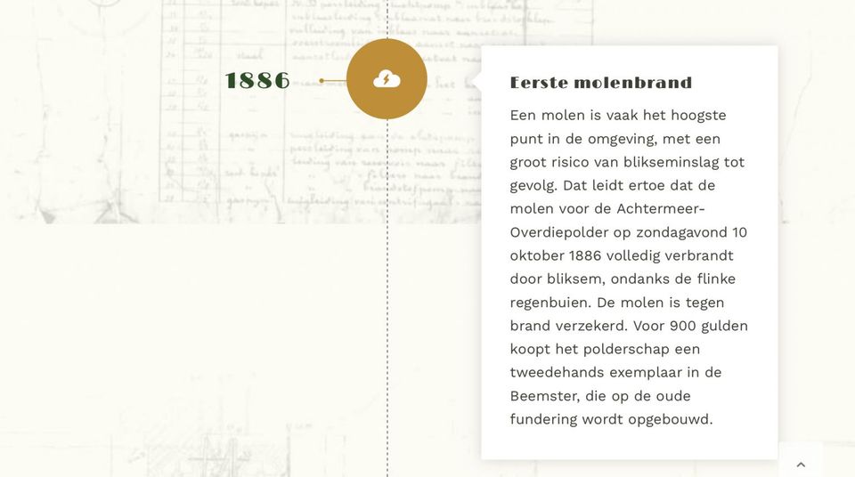
The Meercatje was one of two Kilmills in the Beemster. One stood near the Rijper molengang and the other here, in the middle of the polder on the Middenweg. Both kept the water level in the deepest part of the polder. When, after careful consideration, the Hoofdingelanden decided to switch to steam pumping, the Meercat was sold in 1886 for 900 guilders to the polder board of the Overdie and Achtermeer polder near Alkmaar, because their mill had burned down. The same happened to the old Kilmolen (the Meercatje) as it burned down on its third strand in 1912.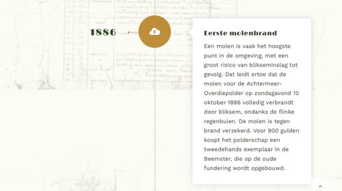
-
-
Sunken windmill sails | Beemster Windmills
Where the Vrouwenweg joins the Noorddijk, you notice how deep the polder is. Whether you pedal briskly up or whizz down, you must or can do it here. During and after the reclamation, this must have been an impressive sight.
Sunken sails | Beemster MillsSunken sails | Beemster Mills
Where the Vrouwenweg joins the Noorddijk, you notice how deep the polder is. Whether you pedal briskly up or whizz down, you must or can do it here. During and after the reclamation, this must have been an impressive sight.
There were eight mills here in 1610, five a year later and in 1936 the largest number, 21.
Draining and then keeping dry feet was a concern. Around 1632, drainage and water levels were radically changed. Mills were moved and new mills were added. Except for the Jispergang, all other corridors were set up as four-stage mill corridors. In four stages, excess water was discharged into the ring canal. After this expansion, there were five four-stage mill strakes at Beets. Between 1635-1636, an additional mill, an out-mill or upper mill, was installed.
After the ironing and until the arrival of steam pumping stations around 1878, all these mills completed the 'beautiful hydraulic work of the Beemster.'
Traces in the landscape
Traces of the former mill corridors are still visible in the landscape. The inventor of the mill corridor was Simon Stevin who received a patent for it that he let expire iin 1609. Jan Adriaansz Leeghwater made grateful use of it at the time.
Where the mills disappeared, houses were built on the former mill yards. Some mill ditches were preserved and others filled in. In order not to forget this image, several works of art have been placed on the dike*. Two mill blades rise just above the land, sunk into the swamp of time.
The reclamation of that great Beemster lake in the 17th century was a world-class achievement and can be compared to the Delta Works in Zeeland in the second half of the 20th century. The investors of the time and all those thousands of hard workers would be surprised if they were here now. No more mills to be seen and still dry feet?
Such is the technical progress in over 400 years since they started the job. Pumping stations with electrically driven pumps and the water level controlled from a laptop. The wooden flood defences have almost all been replaced and by steel or modern ones fitted with solar panels.
* Idea: Beemsters Prosperity.
The miller
The miller was an important man with great responsibilities and he had to hear numerous regulations. In case of emergency, in case of a dike breach or so, he had to do the following.Taking the sails off the mill and rolling them up and taking all the tools to the mill that stood next to the dike, the upper mill. The distress signal had to be given by hanging two fire pans on the mill sails as well as putting down two tar barrels and lighting a straw beacon. A man had to remain behind at the mill at all times. Before then, there was an elaborate emergency plan that attracted a hefty fine if not carried out properly.
The miller's tools included:
"Seylen, some Korde Carts (handcarts), Shovels or Spades, Slonssen (aprons), Vuyr-Pannen, Turcken or Tar Ropes with some Tar-Tonne, dry Reeds or Straw, a batch of Spruces (wooden sticks), Vogel-Roers (guns), Bandeliers (slings), Kruyt and Loot, some Cow-Schuyten or Prams, Candles, Buckets, Carpenter's Tools etc."In the 'Extract Uyt het Octroy van de Beemster etc', the organisation and management of the new polder is extensively documented.
History on the Noorddijk
When the windmills disappeared from the Beemster around 1880, modern times arrived. Steam pumping stations arrived, the millers and their workmen had to find other work. Some were allowed to stay in the small house on the mill yard of the demolished mill, others looked for a house and work elsewhere in the polder or further afield. A new profession did emerge: machinist at a steam pumping station. The violence of the wind was replaced by the heat of steam.
Special places along Noorddijk
At Noorddijk no. 18 stands the old steam pumping station dating from 1877. Beemster was a rich polder and the modernisation of drainage did appeal to the board. The construction of the first pumping station in the Beemster meant the end of the mills.
At No 23 is a white house with the balcony on top of the roof. That is the old polder house complex from 1815 with the carpentry shed next to it. On the roof one could see the signals of the mills in the area.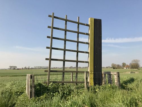
-
-
Beemster windmills
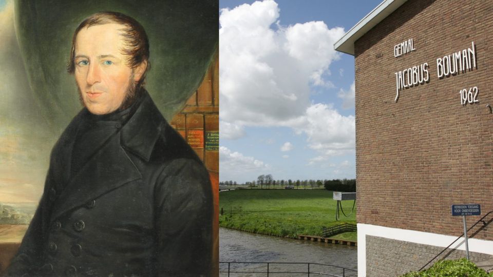
In 1962, the last and then most modern pumping station in the Beemster was installed. Two electric motors can pump the water up 4.5 metres. The water is discharged into the Schermerboezem via the Beemsterringvaart.
Jacobus Bouman pumping station | Beemster MillsJacobus Bouman pumping station | Beemster Mills
In 1962, the last and then most modern pumping station in the Beemster was installed. Two electric motors can pump the water up 4.5 metres. The water is discharged into the Schermerboezem via the Beemsterringvaart.
Do you know that the water in the ring canal stands at -50 cm NAP? N.A.P. height of 0 metres is equal to an average North Sea level. If you want to know how the pumping station works, check out the information board.
This pumping station is named after Jacobus Bouman (1799-1877), a born and bred Beemsterling. A farmer, historian and administrator. He was one of the founders of the Dutch Agricultural Society in 1846.He also wrote the book 'Diking, Rise and Flowering of the Beemster'. In it, he gives a detailed account of the developments in the new polder. From obtaining the patent to draining the Beemster lake, the difficulties during that work and how the new land flourished. A great reference work for those who want to know more about the origins and development the Beemster.
The Beemster ring canal
The Beemster dykes were tackled by the surrounding local administrators over the bridges. After all, the ring canal was a barrier to the movement of goods and people. A small boat was a simple aid, but heavy loads like a carriage or carriage could not carry it. There simply had to be a sturdy bridge that was wide and strong enough for horse and carriage. And as is still often the case today, cost was a major stumbling block.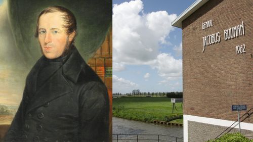
-
-
Belvliet Farm | Beemster Mills
This former estate is already shown on Balthasar Florisz. van Berckenrode's map of 1646. When Cornelis Francois Duyvensz. dies in 1767, Belvliet is valued at fl. 12,000.
Belvliet Farm | Beemster MillsBelvliet Farm | Beemster Mills
This former estate is already shown on Balthasar Florisz. van Berckenrode's map of 1646. When Cornelis Francois Duyvensz. dies in 1767, Belvliet is valued at fl. 12,000.
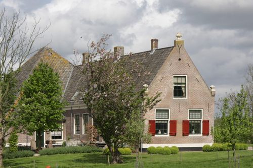
The house would consist of a downstairs and an upstairs room, an inner room, a front and a back room, a kitchen and two attics.
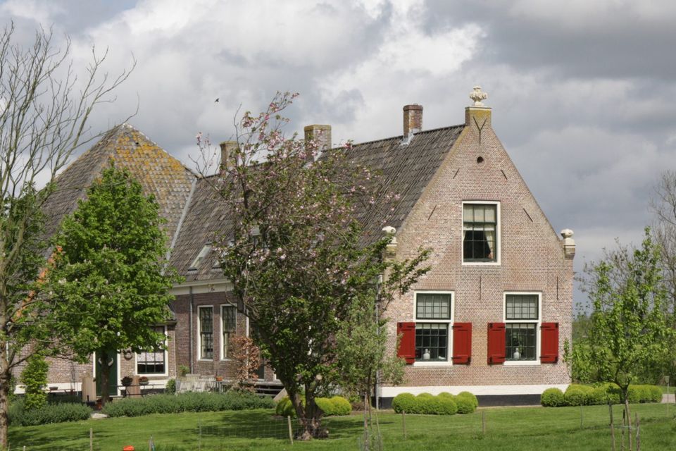
In 2004, it was completely renovated. The front house is part of a former farmstead from 1640 with an attached farmhouse. The current farmhouse was added later.
-
-
The Kwadijker Windmills | Beemster Windmills
The placement of the mills resembled a game of chess against a very unpredictable opponent, nature. In March 1613, there were a total of 43 mills, three of which were at Kwadijk. The Kwadijker mill corridor consisted of four mills in 1635.
The Kwadijker mill corridor | Beemster MillsThe Kwadijker mill corridor | Beemster Mills
The placement of the mills resembled a game of chess against a very unpredictable opponent, nature. In March 1613, there were a total of 43 mills, three of which were at Kwadijk. The Kwadijker mill corridor consisted of four mills in 1635.
End of an era
In 1608, the dykes started the job with 21 mills and by 1610, 26 mills were already grinding the water out of the lake. Mills were moved, mills were added. Three mills in a row became four.50 Mills regulated the water level in the Beemster until the advent of steam pumping stations. This was followed by demolition and sale of the parts. A bold and innovative era was over. In 1888, surveyor A.W. van Kleef stated that there were no more windmills in the Beemster,
The Beemster windmills each had their own number, with the exception of the Meercatje on the Meercatstochtsloot. The mills near de Rijp, Avenhorn and Beets had melodious names: the Volharding and the Knevelaar.
From lake to World Heritage Site
The layout of the reclaimed land, geometrically organised and entirely in the Renaissance style, is still clearly visible. This was one of the reasons why UNESCO included the Beemster Reclamation on the World Heritage List in 1999.
On the Oostdijk near Kwadijk, where a row of windmills once stood, lies Fort Benoorden Purmerend. It is one of the five forts in the Beemster and forms part of the UNESCO World Heritage Site known as the Dutch Waterlines. Here, you find yourself in a piece of World Heritage squared. Unique? Absolutely, because this is where the Dutch Water Lines and the Beemster Reclamation Project converge, creating a ‘World Heritage Site squared!’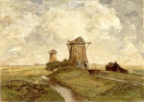
-


- 04
- 46
- 43
- 60
- 07
- 32
- 09
- 04