


World heritage squared
This walking route takes you through no fewer than two World Heritage Sites: Droogmakerij de Beemster and the Stelling van Amsterdam which is part of the UNESCO World Heritage Hollandse Waterlinies. A unique experience!
RouteDykes, forts, an inundation sluice, panoramic views over land reclaimed from the water, the world’s lowest-lying arboretum, thatched farmhouses, and stalls and market stands where, in season, you can buy the most delicious local produce that De Beemster has to offer, straight from the land. You’ll find it all on this walk.
This route can be followed using the signposting of the walking network. The green arrows can be found on lampposts, traffic posts or route markers and will guide you along the route. Along the way, there are various information panels providing further details. You can start this route at Purmerend railway station or at the TOP on the Beemsterburgwal. Thanks to the connecting routes, it is possible to shorten this walking route to a length of 10 or 14 kilometres. The route can be extended to 20 km if you combine it with the Canal Walk or the City Walk through Purmerend.
Dr…
RouteDykes, forts, an inundation sluice, panoramic views over land reclaimed from the water, the world’s lowest-lying arboretum, thatched farmhouses, and stalls and market stands where, in season, you can buy the most delicious local produce that De Beemster has to offer, straight from the land. You’ll find it all on this walk.
This route can be followed using the signposting of the walking network. The green arrows can be found on lampposts, traffic posts or route markers and will guide you along the route. Along the way, there are various information panels providing further details. You can start this route at Purmerend railway station or at the TOP on the Beemsterburgwal. Thanks to the connecting routes, it is possible to shorten this walking route to a length of 10 or 14 kilometres. The route can be extended to 20 km if you combine it with the Canal Walk or the City Walk through Purmerend.
The Beemster Reclamation
The Beemster in North Holland is a textbook example of how the Dutch have reclaimed large parts of their land. This 17th-century land reclamation project was set up to transform the threatening inland waterway known as the Beemster into fertile and profitable farmland. A sturdy dyke 42 kilometres long was built around the wild lake, and a ring canal was dug around it. Forty-three windmills then began pumping the lake dry.
In 1612, De Beemster fell dry and the layout of the polder could begin. Roads were constructed, road ditches and ditches were dug and farms were built. All this was done according to an orderly and strict geometric pattern. De Beemster owes its fame to this rational parcellation and layout.
Hollandse Waterlinies (the Defence Line of Amsterdam)
The Defence Line of Amsterdam is a defensive ring of forts built between 1880 and 1914 15 to 20 kilometres around Amsterdam. Within this ring, the army, the government and the king could retreat in case of (possible) attacks on the Netherlands. An ingenious system allowed the land around the defence line to be flooded. Too shallow for boats and too deep for men and horses. This made raids more difficult. But even before its construction was completed, it was superseded by the rise of the aeroplane.
During the two world wars, the forts were put in a state of defence. In the end, the forts were never fought over. Five forts and an inundation sluice of this line of defence are located in De Beemster. Some of these fascinating structures can still be admired in their original state. Other forts have been given new uses, such as the Fort on Nekkerweg, which is now a wellness resort.
Since July 2021, UNESCO has placed the Hollandse Waterlinies on the World Heritage List. The defence lines, the Defence Line of Amsterdam and the New Dutch Waterline, will continue as a single World Heritage Site under the name 'Hollandse Waterlinies'.
Important information:
- For this route, follow the posts with the green markings/arrows.
- Check the specific route description on the website of Wandelnetwerk Noord-Holland.
- A special route booklet has been developed for this route. Would you like it on paper/digital? Then download the PDF file of recreation authority Twiske-Waterland.
- The free brochure 'Wandelingen' is available from the VVV Purmerend | Museumwinkel and Bezoekerscentrum Beemster.
Tip: Do you encounter any problems along the way? Then report them easily in the Wandelnetwerk Noord-Holland app or via www.meldpuntroutes.nl.
Take a closer look


You are going to see this
-
30
-
Information panel | Slot Purmersteijn | Slotplein
Slotplein is an important, historic spot for Purmerend. Not much of it can be seen now, but until the mid-18th century, a huge castle with substantial donjons at the corners and large halls stood here. Even bigger than the Muiderslot!
Information panel | Slot Purmersteijn | SlotpleinInformation panel | Slot Purmersteijn | Slotplein
Slotplein is an important, historic spot for Purmerend. Not much of it can be seen now, but until the mid-18th century, a huge castle with substantial donjons at the corners and large halls stood here. Even bigger than the Muiderslot!
The important administrative and military centre Slot Purmersteijn was built in 1410 by the wealthy banker Willem Eggert. As tresor of Holland and Zeeland, he was one of the most powerful men in the county. He used his power to tackle fraud and bribery within the Dutch nobility. Under his leadership, West Friesland, Texel and the Kop van Noord-Holland were freed from noble tyranny and most villages gained self-government.
This was not reciprocated by Eggert. During his lifetime, he received many an angry letter from the Dutch nobility. After his death, his family was disposed of by this group, so the name Eggert has no further relevance in Purmerend history. The castle also came back into the hands of the noble families, who left the management entirely to a castellan. Over the centuries, Slot Purmersteijn became a hated symbol of the power of castellors and the Prince of Orange in particular. When the opportunity arose, the Purmerend regents demolished the castle in 1741.
In the castle square, where the entrance to the castle was originally located, you will find only a replica of a piece of the castle wall. Also take a look at the information panel for more information.

-
-
Information panel | Necker-Poort | Neckerdijk
The Neckerpoort is one of the five former gates of the old town of Purmerend.
Information panel | Necker-Poort | NeckerdijkInformation panel | Necker-Poort | Neckerdijk
The Neckerpoort is one of the five former gates of the old town of Purmerend.
When Purmerend was granted city rights in 1410, earthen walls were built around the town to keep out any enemy. Initially, four town gates were built, but a fifth was added after De Beemster was drained. Anyone who wanted to enter the city came through one of these gates, after paying the gate fee of course.
The old, wooden Neckerpoort was later replaced by a stone one. However, to make room for the North Holland Canal, the gate was demolished in 1818. In 2013, the New Neckerpoort was built opposite the location of the old gate, where a fine catering establishment offers a recognisable image of the inns once built around the city gates.
Also take a look at the information panel in front of the bridge.

-
-
79
-
Panels
On the corner of Nieuwstraat and Gouw, you will find panels on the building. These panels show a piece of Purmerend's history.
PanelsPanels
On the corner of Nieuwstraat and Gouw, you will find panels on the building. These panels show a piece of Purmerend's history.
At the corner of Nieuwstraat and Gouw, you will find panels on the premises. These panels show a piece of Purmerend's history.
-
-
Information panel | Post Bridge | Herengracht
The early 20th century saw the first construction outside Purmerend's town walls. The imposing mansions on Herengracht and Emmakade still stand today.
Information panel | Post Bridge | HerengrachtInformation panel | Post Bridge | Herengracht
The early 20th century saw the first construction outside Purmerend's town walls. The imposing mansions on Herengracht and Emmakade still stand today.
A brand new post office was also built. The bridge connecting this neighbourhood to the city centre was therefore called the Post Bridge. The post office has not been used for years, but the bridge's name has stuck.
Also check out the information panel for more information

-
-
99
-
01
-
Information panel | Bastion | Wolthuissingel
The Bastion, also called Bolwerk, was built in 1645 to defend the city.
Information panel | Bastion | WolthuissingelInformation panel | Bastion | Wolthuissingel
The Bastion, also called Bolwerk, was built in 1645 to defend the city.
At this spot, you can still see the contours of this old stronghold, which consisted of a moat and an earthen wall.
The earthen walls have given way to green parks, but the ring of canals is still clearly visible.
Also check out the information panel for more information.

-
-
04
-
31
-
03
-
02
-
44
-
05
-
Koemarkt
Purmerend was a bustling 'Market Town' until the 1980s. Large hordes of cows stood on the Koemarkt every week, ready for sale.
KoemarktKoemarkt
Purmerend was a bustling 'Market Town' until the 1980s. Large hordes of cows stood on the Koemarkt every week, ready for sale.
But there was much more than just trade in cows. How about cheese, fish, sheep and pigs? For each product group there was a specific square allocated in town, this made for a lively town. Tuesday is still market day in Purmerend. The cattle markets are now a thing of the past, though, and so the 'square with the story' has been repurposed. The Koemarkt has become a real catering square with cosy cafés and nice restaurants. Many events also take place here. All this really makes the Koemarkt the 'living room' of the region!

-
-
45
-
Information panel | Cheese market Purmerend
Purmerend's Cheese Market has a market history of over 600 years. The first small-scale market was held here in 1484, when the square was still called Marktveld and was no more than a small square.
Information panel | Cheese market PurmerendInformation panel | Cheese market Purmerend
Purmerend's Cheese Market has a market history of over 600 years. The first small-scale market was held here in 1484, when the square was still called Marktveld and was no more than a small square.
After the reclamation of De Beemster in the early 17th century, the market really started to grow. To cope with this growth, the town underwent some reorganisation. The cattle market was moved to the old Kloosterwerf (now the Koemarkt). The square itself also changed. A few buildings were demolished to make room, the town hall was set back 10 metres, the big church was demolished and even the cemetery was closed and paved over for market trade.
Eventually, all markets were spread across the town and the cheese market was the only place where cheese was traded. With peak years of four million kilos of cheese a year, the Purmerend cheese market was the second largest cheese market in the Netherlands, after Alkmaar. Yet the Purmerend cheese market was more innovative. Whereas in Alkmaar the cheeses were still carried on berries to the Waag by cheese carriers, in Purmerend cheese bins with a wheeled trolley were used. The backs of the cheese carriers lasted longer in Purmerend!
In the mid-20th century, the industrialisation of the dairy industry overtook the traditional Cheese Market. Shortly before 1940, the very last Cheese Market was held in Purmerend. Its success certainly contributed to Purmerend's status as the market town of North Holland. A visit to the Cheese Market is still worthwhile today. You will find terraces, the Nicolaaskerk and the impressive Purmerends Museum in the old town hall. Also take a look at the information panel.

-
-
78
-
Oostdijk / Beemsterringvaart | World heritage site Droogmakerij de Beemster
In 1607, the States of Holland and West Friesland grant permission to reclaim the Beemster. It promises to be a profitable project that could also contribute to the food supply of fast-growing Amsterdam.
Oostdijk / Beemsterringvaart | World heritage site Droogmakerij de BeemsterOostdijk / Beemsterringvaart | World heritage site Droogmakerij de Beemster
In 1607, the States of Holland and West Friesland grant permission to reclaim the Beemster. It promises to be a profitable project that could also contribute to the food supply of fast-growing Amsterdam.
A high and sturdy 38-kilometre-long dyke will be built around the lake and, in turn, a ring canal around it. Then the draining of the lake begins, which requires as many as 43 windmills. Engineer Jan Adriaenszoon Leeghwater is jointly responsible for the construction and placement of the mills. Windmill corridors are used: several windmills one after the other, each pumping the water from the lake a little higher into the ring canal.
In 1612, the lake falls dry and the layout of the polder can begin. Roads are constructed, ditches are dug and farmhouses are built. All this was done according to an orderly and strict geometric pattern. The Beemster owed its fame to this way of dividing and allocating land.
The Netherlands has been shaped by human intervention in nature. This begins as early as the sixth century BC with the construction of mounds and wierden for safe living. In the Middle Ages, land reclamation and embankment on an increasingly larger scale and the establishment of water boards followed. From the sixteenth century, water management was tackled on an even larger and more systematic scale with the reclamation of lakes and peat ponds. Today, the Beemster is on the UNESCO list of World Heritage Sites. This reclamation area is a textbook example of how the Dutch 'made' large parts of their country themselves.

-
-
Information panel | Buter family
On this information panel, read about the family of Cornelis Buter (1888), who was forced to become a fort guard at Fort Benoorden Purmerend during World War II.
Information panel | Buter familyInformation panel | Buter family
On this information panel, read about the family of Cornelis Buter (1888), who was forced to become a fort guard at Fort Benoorden Purmerend during World War II.
Read on this information panel about the family of Cornelis Buter (1888), who was forced to become a fort guard at Fort Benoorden Purmerend during World War II.
-
-
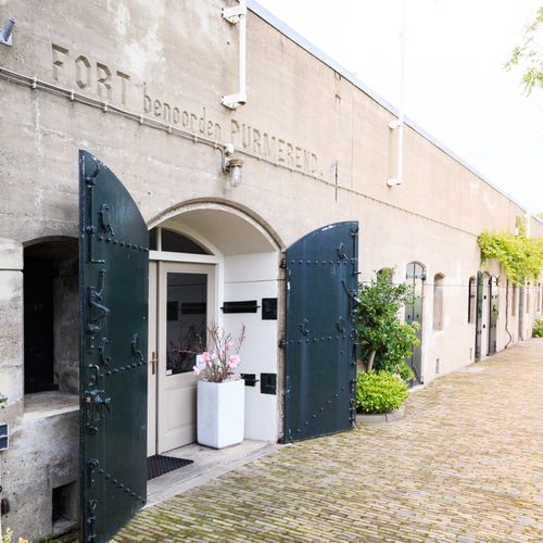
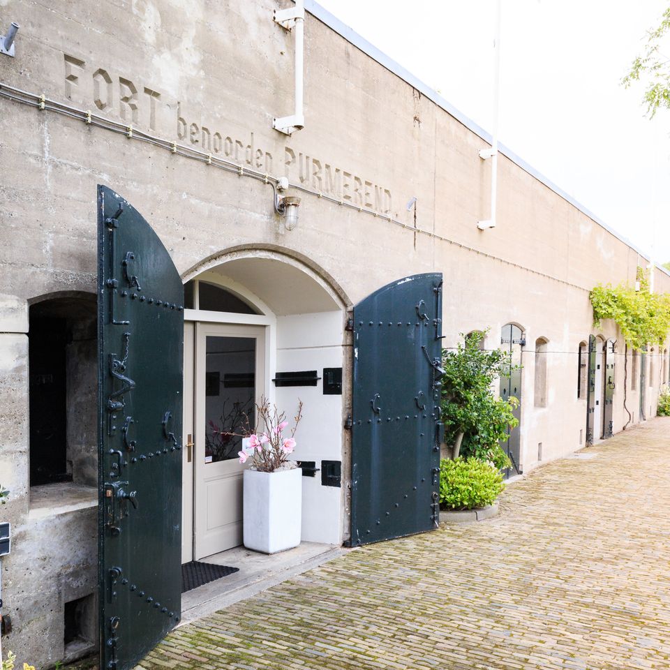
Fort Benoorden | Purmerend
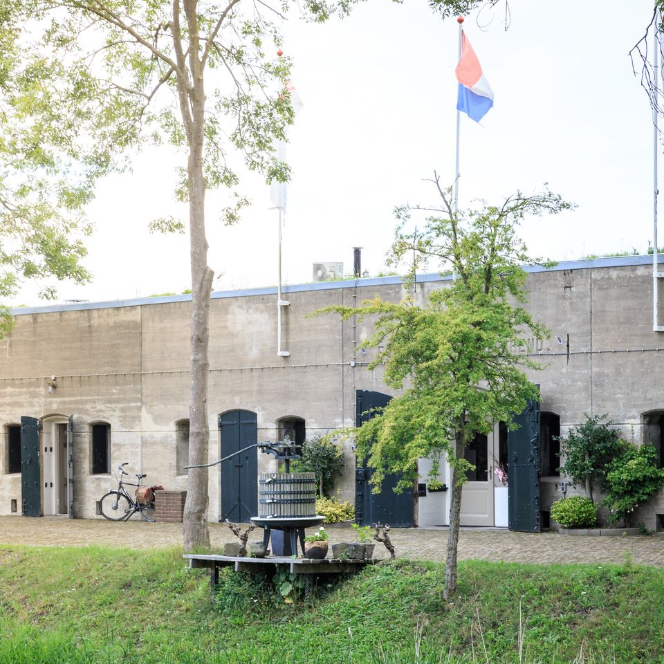
Fort Benoorden is part of the Defence Line of Amsterdam and is part of the UNESCO World Heritage site 'Hollandse Waterlinies'. This defensive line of forts was built 15 to 20 kilometres around Amsterdam between 1880 and 1914.
Fort Benoorden | PurmerendFort Benoorden | Purmerend
Fort Benoorden is part of the Defence Line of Amsterdam and is part of the UNESCO World Heritage site 'Hollandse Waterlinies'. This defensive line of forts was built 15 to 20 kilometres around Amsterdam between 1880 and 1914.
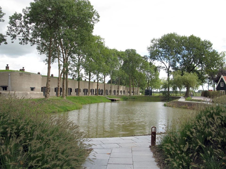
Within this ring, the army, government and king could retreat in case of (possible) attacks on the Netherlands. An ingenious system allowed the land around the defence line to be flooded. Too shallow for boats and too deep for men and horses. Five forts and an inundation sluice of this defence line are located in De Beemster.
This fort was built to defend the vulnerable points formed by the Beemsterringdijk, Purmerenderweg and Rijperweg roads. The defensible earthwork was completed in 1895. The bombproof main building from 1912 is connected by covered corridors to the two lifting turret buildings. Today, wine is stored between the thick walls of this fort, as a wine importer has been located here since 1981.
The fort north of Purmerend was only added to the Defence Line of Amsterdam at a late stage (1907). The construction of this fort, which is part of the northern front of the Defence Line, made use of several new insights. One of the novelties applied was the construction of so-called poternes - corridors covered with steel and concrete - which formed a completely safe connection between the main building and the artillery units.
Poternes were constructed to the two lifting turrets, which housed the large artillery pieces, and to the machine gun emplacements set up at the front. On the right side of the fort's front, part of the terrain was excavated. This was done when a new access road was built.
-
-
Information panel | Farm Deutzen-Hofje
This farm owes its name to the 17th-century Agneta Deutz. Read the information panel to learn more.
Information panel | Farm Deutzen-HofjeInformation panel | Farm Deutzen-Hofje
This farm owes its name to the 17th-century Agneta Deutz. Read the information panel to learn more.
This farm owes its name to the 17th-century Agneta Deutz. Read the information panel to learn more.
-
-
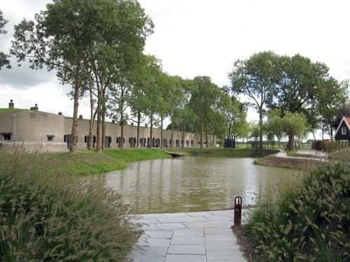
Fort along Nekkerweg
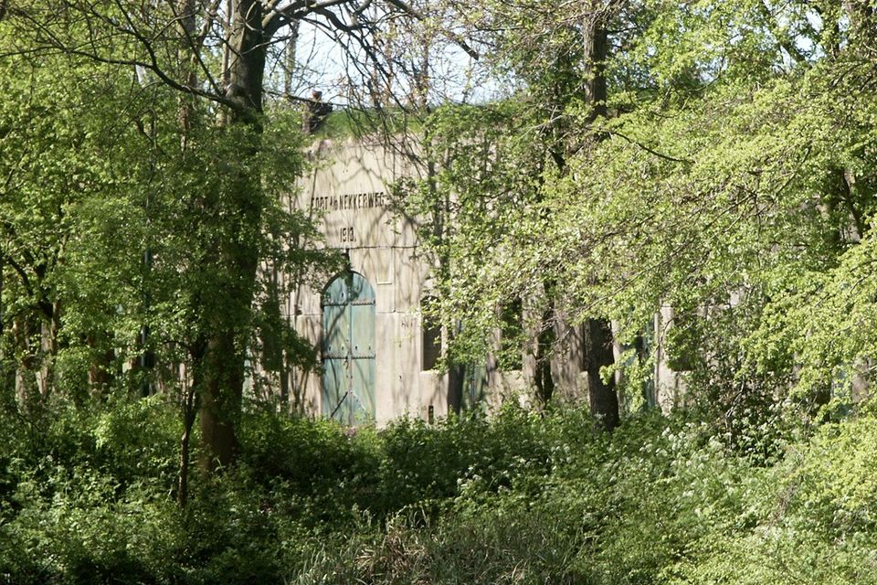
The fort on Nekkerweg is part of the Defence Line of Amsterdam and is part of the UNESCO World Heritage site 'Hollandse Waterlinies'. This defensive line of forts was built 15 to 20 kilometres around Amsterdam between 1880 and 1914.
Fort along NekkerwegFort along Nekkerweg
The fort on Nekkerweg is part of the Defence Line of Amsterdam and is part of the UNESCO World Heritage site 'Hollandse Waterlinies'. This defensive line of forts was built 15 to 20 kilometres around Amsterdam between 1880 and 1914.
This fort created a kink in the main defence line. To prevent the Zuidoostbeemster from being flooded when the Beemster Polder was inundated, both the Nekkerweg and the Volgerweg were raised. This fortress had to prevent the enemy from moving easily via these two elevated roads.
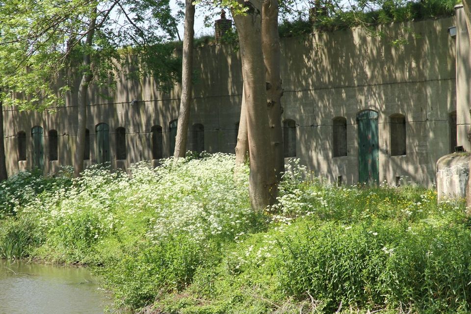
The Fort on Nekkerweg was not completed until 1912. The fort changed its use almost immediately afterwards. In 1918, it was put into use as a military prison. In the period that followed, many conscientious objectors mainly served their sentences here. Almost nothing remains of the fort's original interior. However, the concrete machine gun emplacements on the front wall remain reasonably intact, as does the fort watchman's house.
The fort that once housed soldiers has now been transformed into a luxury eco-chic wellness resort, with two restaurants and 16 luxurious rooms and suites.
-
-
77
-
Rustenhove
Rustenhove was built in 1786 as a mansion on the site of a defunct homestead. The fine cast-iron gate and arched bridge date from the same period.
RustenhoveRustenhove
Rustenhove was built in 1786 as a mansion on the site of a defunct homestead. The fine cast-iron gate and arched bridge date from the same period.
The beautiful front door and the window above form a whole in the frame in which the date 1786 and two coats of arms are inscribed. The statue to the right of the farmhouse is the god Jupiter, in 1646 the name of the then buitenplaats. The statue is from the polder house on Noorddijk in Beemster, which once started as a cattle farm, is now an arable farm.
Read the information panel for more information

-
-
Volgerweg/Middenweg intersection
This intersection is also known as the 'crossroads of four centuries of architecture'.
Volgerweg/Middenweg intersectionVolgerweg/Middenweg intersection
This crossroads is also known as the 'crossroads of four centuries of architecture'.
On Middenweg is farm de Eenhoorn from 1682, on Volgerweg a house built in the 20th century and next to it is Rustenhoven from 1768. Opposite this mansion is a farm built in the 19th century, containing the collection garden of the POMological Society North Holland. Over 250 fruit varieties have been newly planted here.

-
-
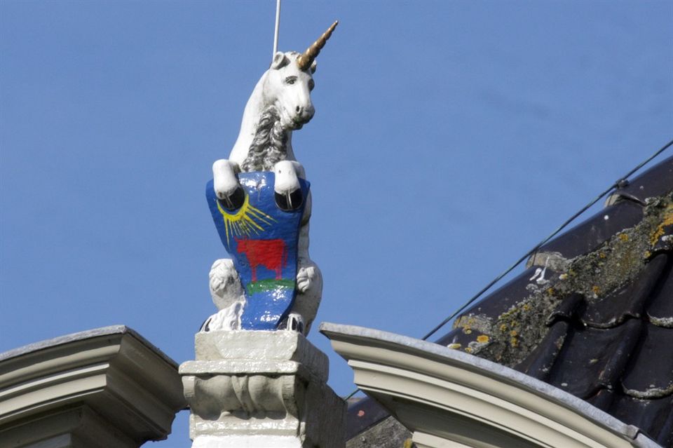
Farm "The Unicorn"
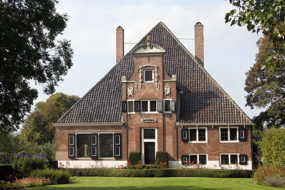
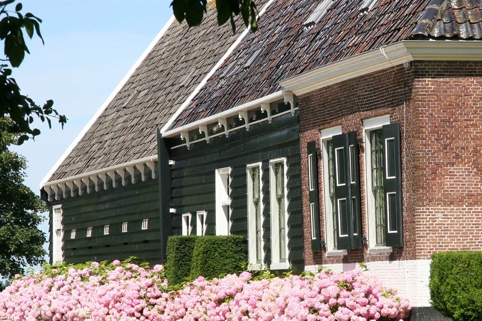
Farmhouse "De Eenhoorn" is the richest example of a stolp farm in De Beemster. The living area is made of brick and the barn area extended backwards is made of wood.
Farm "The Unicorn"Farm "The Unicorn"
Farmhouse "De Eenhoorn" is the richest example of a stolp farm in De Beemster. The living area is made of brick and the barn area extended backwards is made of wood.
The raised central part with neck gable is a variant of the Amsterdam Vingboons style (Philip Vingboons), crowned with, among other things, the statue of a unicorn and decorated with carved gable ornaments and a cartouche with 1682. The living area is partly cellared and the milk cellar has a tiled fireplace.
Typical of these farms are the large orchards. These had several functions: in addition to fruit production, they provided coppicing and tool wood. In early spring, sheep and their newborn lambs roamed there. Later in summer, calves grazed there. The client then was the mayor of Hoorn.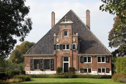
-
-
Fort along Middenweg
The fort on Middenweg is part of the Defence Line of Amsterdam and is part of the UNESCO World Heritage Site 'Hollandse Waterlinies'. This defensive line of forts was built 15 to 20 kilometres around Amsterdam between 1880 and 1914.
Fort along MiddenwegFort along Middenweg
The fort on Middenweg is part of the Defence Line of Amsterdam and is part of the UNESCO World Heritage Site 'Hollandse Waterlinies'. This defensive line of forts was built 15 to 20 kilometres around Amsterdam between 1880 and 1914.
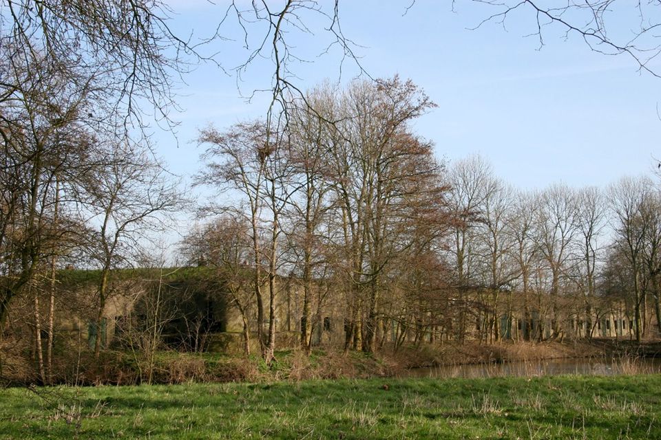
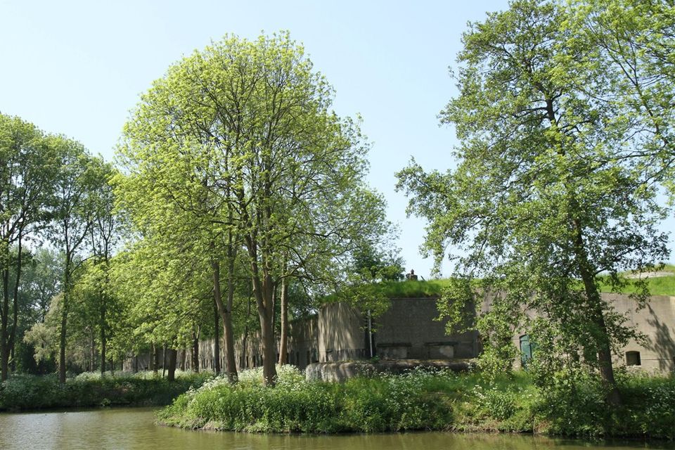
The fort is located on the southern ring dyke of polder De Beemster. The North Holland Canal runs behind the fort and the dike. An inundation sluice for the Beemster is located east of the fort. The purpose of the fort was to seal off and defend the accesses formed by the Middenweg and Zuiddijk roads. The original situation around the fort has been preserved: open polder landscape outside the Defence Line and the dike and canal inside the Defence Line.
The fort was used as a warehouse complex from unknown date until after 1974 and on 1-12-1950 as a gunpowder magazine. Later used by Eurometaal (vm Artillerie Inrichtingen); still in use in 1980/1983. Narrow gauge track was present for this purpose.
Facilities for a Detention and Residence Camp for political offenders were partially made in 1946 but the fort was not used as a camp.
Flora & Fauna are of great natural value. Due to strong temperature changes on the barren fort site, distinct dune vegetation occurs here. To be found are, among others, Wall Pepper, Sand Wall, Common Wallow, Jacob's Cross and Rough forget-me-not. Also found are Wolf's-foot, Red-water-herb and Pennywort. Long-eared owl and freshwater prawn are also residents of the nature reserve around the fort.A special feature of this fort was the washroom for the soldiers. An ingenious system cleans rainwater before it enters the wash basins. The sinks themselves can be tipped over so that the dirty water flows away.
The Fort on Middenweg can be admired but not visited.

-
-
49
-
Inundation sluice in South Beemster ring dyke
The Inundation Lock is part of the Defence Line of Amsterdam and was constructed by the Department of War between 1890 and 1891.
Inundation sluice in South Beemster ring dykeInundation sluice in South Beemster ring dyke
The Inundation Lock is part of the Defence Line of Amsterdam and was constructed by the Department of War between 1890 and 1891.
The sluice formed the main point in the water control of the Beemster polder and was built for the purpose of "flooding the Beemster polder". It consisted of a sluice section in the dyke body and then a bowl section in the upper Beemster polder. Water from the North Holland Canal was let into the polder via this bowl. When the polder was flooded in 1940, it was done via this lock. After its military function ceased, the lock fell into disuse. The openings on the canal side were sealed with concrete and the sluiceways and discharge bed with earth.

-
-
Information panel | Water against the Enemy
Read the story of the Inundation Lock from World War II to the present on this information panel.
Information panel | Water against the EnemyInformation panel | Water against the Enemy
Read the story of the Inundation Lock from World War II to the present on this information panel.
This information panel tells the story of the Inundation Lock from World War II to the present day.
-
-
76
-
Information panel | Beemster War Memories
Read about De Beemster in World War II on this information panel.
Information panel | Beemster War MemoriesInformation panel | Beemster War Memories
Read about De Beemster in World War II on this information panel.
Read about De Beemster during the Second World War on this information panel.
-
-
Information panel | Beemster Gate | Beemsterburgwal
The Beemster Gate was the fifth and last town gate built around Purmerend.
Information panel | Beemster Gate | BeemsterburgwalInformation panel | Beemster Gate | Beemsterburgwal
The Beemster Gate was the fifth and last town gate built around Purmerend.
The first four gates were built after obtaining city rights in 1410. The need for a fifth gate presented itself after the reclamation of De Beemster in 1612. A simple wooden gate was built on the bridge from the city to the newly acquired land: The Beemster Gate. When De Beemster was dry and the roads passable, people used this route to move towards Oosthuizen and Hoorn. As a result, the access road via the Hoornsche Poort was hardly used anymore.
During a period of peace, the city walls and city gates became redundant as defence works. Should an enemy still come, the drawbridges could be used to protect the town. Between 1830 and 1840, all gates in Purmerend, except the Amsterdamsche Poort, were demolished. Check out the information panel for more information.

-
-
Information panel | Special residence
Read information about this special residential house on this information panel
Information panel | Special residenceInformation panel | Special residence
Read information about this special residential house on this information panel
Read information on this information panel about this special house
-
-
Information panel | Marienheuvel
Mariënheuvel is one of De Beemster's last remaining country estates. Read the information panel to learn more.
Information panel | MarienheuvelInformation panel | Marienheuvel
Mariënheuvel is one of De Beemster's last remaining country estates. Read the information panel to learn more.
Mariënheuvel is one of the last remaining estates in De Beemster. Read the information panel to learn more.
-
-
Information panel | Wooden house
This wooden house was built according to the circle law. Read the information panel to learn more about it.
Information panel | Wooden houseInformation panel | Wooden house
This wooden house was built according to the circle law. Read the information panel to learn more about it.
This wooden house was built according to the circular law. Read the information panel to learn more about it.
-
-
29
-
30








- 30
- 79
- 99
- 01
- 04
- 31
- 03
- 02
- 44
- 05
- 45
- 78
- 77
- 49
- 76
- 29
- 30